|
search place name
|
||
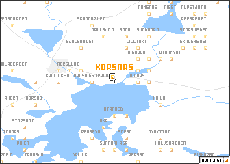
Korsnäs (Dalarna, Sweden)Korsnäs is a town in the Dalarna region of Sweden. An overview map of the region around Korsnäs is displayed below.
regional and 3d topo map of Korsnäs, Sweden ::
Korsnäs airports ::
The nearest airport is BLE - Borlange, located 21.1 km south west of Korsnäs.
Other airports nearby include GVX - Gavle (67.7 km east), MXX - Mora (77.8 km north west), VST - Vasteras (121.9 km south east), HUV - Hudiksvall (151.0 km north east), Nearby towns ::
Uddnäs (1.8km east) //
Hälsingstrand (1.8km west) //
Hosjöholmen (2.6km north east) //
Risholn (4.1km north east) //
Utanhed (5.6km south) //
Lönnemossa (2.7km east) //
Björnmyra (5.6km north) //
Färnviken (5.6km south) //
Haraldsbo (3.3km north west) //
Hälsingborn (3.3km north east) //
Lilltäkt (5.8km north) //
Danholn (4.6km north east) //
Backa (4.6km north east) //
Vika (7.5km south) //
Hobborn (7.5km north) //
Boda (7.5km north) //
Gallsjön (7.5km north) //
Norslund (4.1km north west) //
Sjulsarvet (6.2km north west) //
Kniva (5.2km south east) //
Superbacka (5.2km north east) //
Sundborn (7.9km north) //
[all distances 'as the bird flies' and approximate] 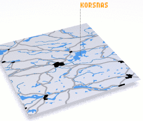 Places with similar names to Korsnäs, Sweden ::
Disclaimer :: Information on this page comes without warranty of any kind |
||
|
Where is Korsnäs? Elevation and coordinates ::
Latitude (lat): 60°35'0"N Longitude (lon): 15°43'0"E
(map arrows pan, magnifying glasses zoom) |
||
|
Visiting Korsnäs? Hotel/Accommodation ::
Book a hotel in Korsnäs Travel Guide ::
Buy a travel guide for Sweden rental cars ::
car rental offers GPS waypoint ::
download a GPX waypoint (PoI) of Korsnäs for your GPS receiver
|
||