|
search place name
|
||
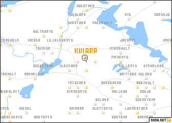
Kviarp (Jönköping, Sweden)Kviarp is a town in the Jönköping region of Sweden. An overview map of the region around Kviarp is displayed below.
regional and 3d topo map of Kviarp, Sweden ::
Kviarp airports ::
The nearest airport is JKG - Joenkoeping Jonkoping, located 23.7 km west of Kviarp.
Other airports nearby include KVB - Skovde (83.9 km north), HLF - Hultsfred (84.8 km east), VXO - Vaxjo Kronoberg (92.8 km south), LPI - Linkoeping Saab (102.3 km north east), Nearby towns ::
Östra Höreda (1.0km east) //
Västra Höreda (1.0km west) //
Byhult (1.9km south) //
Klackarp (2.7km south west) //
Forserum (5.6km south) //
Tryggarp (5.6km south) //
Lilla Lekeryd (4.7km north west) //
Fageräng (4.7km north west) //
Kanarp (5.9km south) //
Finneryd (4.0km east) //
Hult (7.4km north) //
Nybrohult (4.4km north east) //
Stenseryd (7.5km south) //
Lutarp (7.5km north) //
Svartorp (7.5km north) //
Lekeryd (4.4km north west) //
Rönjane (6.3km north west) //
Broddarp (6.3km south east) //
Fåglarp (6.3km south east) //
Skogsåkra (6.3km south east) //
Fagerhult (7.7km north) //
Roestorp (8.0km north) //
Mållebo (8.4km south east) //
[all distances 'as the bird flies' and approximate] 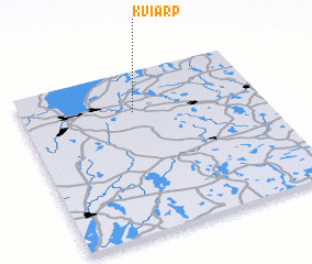 Places with similar names to Kviarp, Sweden ::
Disclaimer :: Information on this page comes without warranty of any kind |
||
|
Where is Kviarp? Elevation and coordinates ::
Latitude (lat): 57°45'0"N Longitude (lon): 14°28'0"E
Elevation (approx.): 252m (map arrows pan, magnifying glasses zoom) |
||
|
Visiting Kviarp? Hotel/Accommodation ::
Book a hotel in Kviarp Travel Guide ::
Buy a travel guide for Sweden rental cars ::
car rental offers GPS waypoint ::
download a GPX waypoint (PoI) of Kviarp for your GPS receiver
|
||