|
search place name
|
||
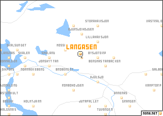
Långåsen (Örebro, Sweden)Långåsen is a town in the Örebro region of Sweden. An overview map of the region around Långåsen is displayed below.
regional and 3d topo map of Långåsen, Sweden ::
Långåsen airports ::
The nearest airport is KSK - Karlskoga, located 55.9 km south of Långåsen.
Other airports nearby include ORB - Orebro (70.1 km south), BLE - Borlange (78.7 km north east), VST - Vasteras (110.4 km east), MXX - Mora (125.9 km north), Nearby towns ::
Bredsjö (0.0km north) //
Bysjötorp (1.9km east) //
Mosserud (2.6km north west) //
Broberget (4.1km south west) //
Lilla Havsjön (4.1km north east) //
Bjursjöhöjden (5.6km north) //
Bergmästarbacken (3.4km south east) //
Hjulsjö (5.9km south) //
Småland (3.7km west) //
Grönhult (3.7km west) //
Kampbacken (3.7km west) //
Björksjön (3.7km east) //
Rombohöjden (7.5km south) //
Jönshyttan (4.2km south west) //
Gränsjöhöjden (7.5km north) //
Stora Havsjön (7.6km north) //
[all distances 'as the bird flies' and approximate]  Places with similar names to Långåsen, Sweden ::
// Lancacen (PH)
// Linguisan (PH)
// Langgassen (DE)
// Long San (MY)
// Long Seniai (MY)
// Lang Suan (TH)
// Lungsen (IN)
// Langgasuno (ID)
// Làng Sen (LA)
// Làng San (VN)
Disclaimer :: Information on this page comes without warranty of any kind |
||
|
Where is Långåsen? Elevation and coordinates ::
Latitude (lat): 59°50'0"N Longitude (lon): 14°44'0"E
Elevation (approx.): 193m (map arrows pan, magnifying glasses zoom) |
||
|
Visiting Långåsen? Hotel/Accommodation ::
Book a hotel in Långåsen Travel Guide ::
Buy a travel guide for Sweden rental cars ::
car rental offers GPS waypoint ::
download a GPX waypoint (PoI) of Långåsen for your GPS receiver
|
||