|
search place name
|
||
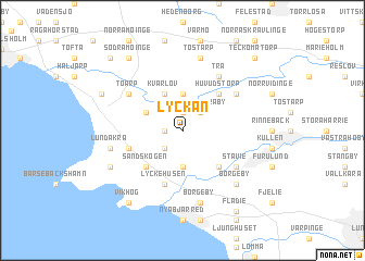
Lyckan ((( Kristianstad )), Sweden)Lyckan is a town in the (( Kristianstad )) region of Sweden. An overview map of the region around Lyckan is displayed below.
regional and 3d topo map of Lyckan, Sweden ::
nearby GPS traces from timatio ::
Lyckan airports ::
The nearest airport is JLD - Landskrona, located 18.5 km north west of Lyckan.
Other airports nearby include CPH - Copenhagen Kastrup (30.4 km south west), MMX - Malmoe Sturup (37.4 km south east), RKE - Copenhagen Roskilde (60.6 km south west), KID - Kristianstad (68.3 km east), Nearby towns ::
Björnstorp (1.0km west) //
Hänkelstorp (1.0km west) //
Dösjebro (1.9km north) //
Västra Karaby (2.1km north east) //
Håkantorp (2.1km south west) //
Löddeköpinge (3.7km south) //
Annelöv (3.7km north) //
Kvärlöv (3.9km north) //
Ålstorp (2.8km north west) //
Hög (4.3km south east) //
Huvudstorp (4.3km north east) //
Sandskogen (4.3km south west) //
Lyckehusen (5.7km south) //
Hofterup (3.6km south west) //
Andersro (3.6km south west) //
Stävie (4.8km south east) //
Björnahusen (4.8km north west) //
Toarp (4.8km north west) //
Saxtorp (4.8km north west) //
Dagstorp (4.8km north east) //
Trä (5.9km north) //
Borgeby (7.5km south) //
Tostarp (7.5km north) //
Lundåkra (4.6km south west) //
Borgeby (6.4km south east) //
Barsebäck (5.6km south west) //
Hugodal (5.6km south west) //
Saxtorpsskogen (6.0km north west) //
Vikhög (8.0km south west) //
[all distances 'as the bird flies' and approximate]  Places with similar names to Lyckan, Sweden ::
Disclaimer :: Information on this page comes without warranty of any kind |
||
|
Where is Lyckan? Elevation and coordinates ::
Latitude (lat): 55°48'0"N Longitude (lon): 13°1'0"E
Elevation (approx.): 14m (map arrows pan, magnifying glasses zoom) |
||
|
Visiting Lyckan? Hotel/Accommodation ::
Book a hotel in Lyckan Travel Guide ::
Buy a travel guide for Sweden rental cars ::
car rental offers GPS waypoint ::
download a GPX waypoint (PoI) of Lyckan for your GPS receiver
|
||