|
search place name
|
||
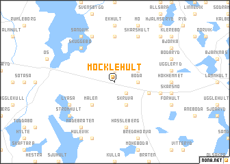
Möcklehult (Jönköping, Sweden)Möcklehult is a town in the Jönköping region of Sweden. An overview map of the region around Möcklehult is displayed below.
regional and 3d topo map of Möcklehult, Sweden ::
Möcklehult airports ::
The nearest airport is VXO - Vaxjo Kronoberg, located 31.9 km south east of Möcklehult.
Other airports nearby include JKG - Joenkoeping Jonkoping (69.4 km north), HLF - Hultsfred (92.8 km north east), HAD - Halmstad (111.6 km south west), RNB - Ronneby (112.4 km south east), Nearby towns ::
Slättö (1.9km north) //
Älmhult (2.1km south east) //
Boda (2.0km east) //
Hylte (2.7km north east) //
Gigaryd (2.7km north east) //
Skruva (3.8km south) //
Målen (4.2km south west) //
Sandbäcken (3.5km south east) //
Applehult (7.4km north) //
Hässleberg (7.5km south) //
Skärshult (4.4km south east) //
Skuggebo (6.3km north west) //
Intäkt (7.7km north) //
Skärshult (7.7km north) //
Lyåsa (5.5km south west) //
Sandvik (8.0km north) //
Strömhult (6.9km south west) //
Madebråten (8.0km south) //
Föreberg (8.4km north east) //
[all distances 'as the bird flies' and approximate] 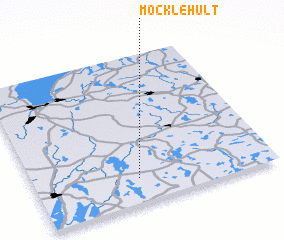 Places with similar names to Möcklehult, Sweden ::
// Miklholt (IS)
// Maglehult (SE)
// Maglehult (SE)
// Möcklehult (SE)
// Möcklehult (SE)
// Möklehult (SE)
// Mekkelholt (NL)
Disclaimer :: Information on this page comes without warranty of any kind |
||
|
Where is Möcklehult? Elevation and coordinates ::
Latitude (lat): 57°10'0"N Longitude (lon): 14°26'0"E
Elevation (approx.): 214m (map arrows pan, magnifying glasses zoom) |
||
|
Visiting Möcklehult? Hotel/Accommodation ::
Book a hotel in Möcklehult Travel Guide ::
Buy a travel guide for Sweden rental cars ::
car rental offers GPS waypoint ::
download a GPX waypoint (PoI) of Möcklehult for your GPS receiver
|
||