|
search place name
|
||
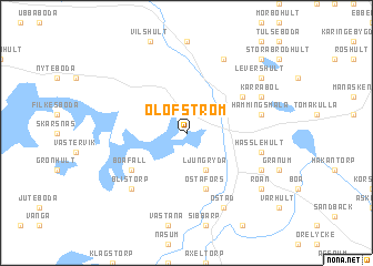
Olofström (Blekinge, Sweden)Olofström is a town in the Blekinge region of Sweden. An overview map of the region around Olofström is displayed below.
regional and 3d topo map of Olofström, Sweden ::
Olofström airports ::
The nearest airport is KID - Kristianstad, located 46.3 km south west of Olofström.
Other airports nearby include RNB - Ronneby (47.4 km east), VXO - Vaxjo Kronoberg (75.1 km north), JLD - Landskrona (107.6 km west), MMX - Malmoe Sturup (108.2 km south west), Nearby towns ::
Holje (2.1km north east) //
Ljungryda (3.8km south) //
Jämshög (3.8km south) //
Östafors (5.7km south) //
Biskopsmåla (4.8km north east) //
Boafall (4.8km south west) //
Hämmingsmåla (4.5km north east) //
Hässlehult (4.5km south east) //
Blistorp (6.4km south west) //
Snöfleboda (7.7km north) //
Kärrabol (5.5km north east) //
Östad (7.7km south) //
Gillaruna (5.5km south east) //
Levershult (6.9km north east) //
Röan (6.9km south east) //
Källeboda (8.5km north east) //
[all distances 'as the bird flies' and approximate] 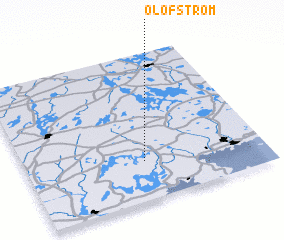 Places with similar names to Olofström, Sweden :: Disclaimer :: Information on this page comes without warranty of any kind |
||
|
Where is Olofström? Elevation and coordinates ::
Latitude (lat): 56°16'0"N Longitude (lon): 14°30'0"E
Elevation (approx.): 91m (map arrows pan, magnifying glasses zoom) |
||
|
Visiting Olofström? Hotel/Accommodation ::
Book a hotel in Olofström Travel Guide ::
Buy a travel guide for Sweden rental cars ::
car rental offers GPS waypoint ::
download a GPX waypoint (PoI) of Olofström for your GPS receiver
|
||