|
search place name
|
||
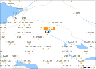
Risholn (Dalarna, Sweden)Risholn is a town in the Dalarna region of Sweden. An overview map of the region around Risholn is displayed below.
regional and 3d topo map of Risholn, Sweden ::
Risholn airports ::
The nearest airport is MXX - Mora, located 41.3 km north west of Risholn.
Other airports nearby include BLE - Borlange (45.5 km south), GVX - Gavle (98.4 km east), EVG - Sveg (145.1 km north), HUV - Hudiksvall (147.7 km north east), Nearby towns ::
Slättberg (2.6km south west) //
Mårtanberg (4.1km north east) //
Veberg (5.6km south) //
Kilen (5.6km south) //
Hoberg (5.6km south) //
Almbergsbjörken (6.2km south west) //
Almberg (6.2km south west) //
Böle (5.2km south west) //
Östergrav (5.2km north west) //
Söderås (5.2km north west) //
Hyttkvarn (6.6km south east) //
Hisvåla (8.3km south west) //
Årboheden (8.3km south east) //
[all distances 'as the bird flies' and approximate]  Places with similar names to Risholn, Sweden ::
// Rachoúlion (GR)
// Rachelany (PL)
// Rochalina (PL)
// Richlawn (US)
// R. Chiluane (MZ)
// Rechlin (DE)
// Risholn (SE)
Disclaimer :: Information on this page comes without warranty of any kind |
||
|
Where is Risholn? Elevation and coordinates ::
Latitude (lat): 60°48'0"N Longitude (lon): 15°12'0"E
(map arrows pan, magnifying glasses zoom) |
||
|
Visiting Risholn? Hotel/Accommodation ::
Book a hotel in Risholn Travel Guide ::
Buy a travel guide for Sweden rental cars ::
car rental offers GPS waypoint ::
download a GPX waypoint (PoI) of Risholn for your GPS receiver
|
||