|
search place name
|
||
Bantanto (Guinea-Bissau)Bantanto is a town in Guinea-Bissau. An overview map of the region around Bantanto is displayed below.
regional and 3d topo map of Bantanto, Guinea-Bissau ::

Bantanto airports ::
The nearest airport is TUD - Tambacounda, located 141.2 km north of Bantanto.
Other airports nearby include KGG - Kedougou (170.3 km east), LEK - Labe (206.2 km south east), BXO - Bissau Oswaldo Vieira Intl (213.2 km west), Nearby towns ::
Canhà (1.8km west) //
Iero Malè (3.6km east) //
Canchalica (4.1km north east) //
Jaucunda (4.1km south west) //
Cossarè (5.7km west) //
Sinchã Jótè (6.6km north east) //
Sinchã Cáchajà Bovè (6.6km north west) //
Sare Burè (6.6km south east) //
Campafè (7.2km west) //
Sinchã Lenquetó (7.6km south) //
Sinchã Candébè (7.6km south) //
Cáchajà (7.8km north west) //
Sinchã Boído (9.2km north west) //
Cacháquè (9.1km north west) //
Sinchã Ajanco (10.4km south east) //
[all distances 'as the bird flies' and approximate] 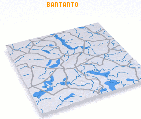 Places with similar names to Bantanto, Guinea-Bissau ::
// Ban Dan Tae (TH)
// Ban Don Du (TH)
// Ban Don Du (TH)
// Ban Don Du (TH)
// Ban Don Du (TH)
// Ban Don Du (TH)
// Ban Don Du (TH)
// Ban Don Du (TH)
// Ban Don Dua (TH)
// Ban Don Dua (TH)
Disclaimer :: Information on this page comes without warranty of any kind |
||
|
Where is Bantanto? Elevation and coordinates ::
Latitude (lat): 12°28'0"N Longitude (lon): 13°47'0"W
Elevation (approx.): 73m (map arrows pan, magnifying glasses zoom) |
||
|
Visiting Bantanto? Hotel/Accommodation ::
Book a hotel in Bantanto Travel Guide ::
rental cars ::
car rental offers GPS waypoint ::
download a GPX waypoint (PoI) of Bantanto for your GPS receiver
|
||