|
search place name
|
||
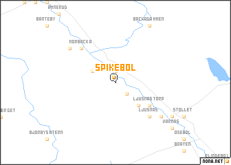
Spikebol (Värmland, Sweden)Spikebol is a town in the Värmland region of Sweden. An overview map of the region around Spikebol is displayed below.
regional and 3d topo map of Spikebol, Sweden ::
Spikebol airports ::
The nearest airport is MXX - Mora, located 90.5 km north east of Spikebol.
Other airports nearby include KSK - Karlskoga (146.9 km south east), ORB - Orebro (175.2 km south east), EVG - Sveg (186.9 km north), Nearby towns ::
Ambjörby (1.9km north) //
Munkebol (1.9km north) //
Björkenäs (2.1km south east) //
Månäs (2.6km north west) //
Ändenäs (4.1km south east) //
Ljusnästorp (4.6km south east) //
Ljusnäs (6.2km south east) //
Mörbacka (6.2km north west) //
Övre Värnäs (6.7km south east) //
Hjällstad (6.6km north west) //
[all distances 'as the bird flies' and approximate] 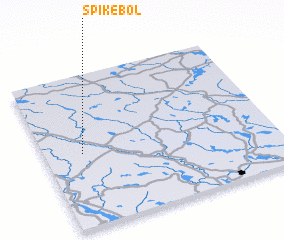 Places with similar names to Spikebol, Sweden :: Disclaimer :: Information on this page comes without warranty of any kind |
||
|
Where is Spikebol? Elevation and coordinates ::
Latitude (lat): 60°29'0"N Longitude (lon): 13°10'0"E
(map arrows pan, magnifying glasses zoom) |
||
|
Visiting Spikebol? Hotel/Accommodation ::
Book a hotel in Spikebol Travel Guide ::
Buy a travel guide for Sweden rental cars ::
car rental offers GPS waypoint ::
download a GPX waypoint (PoI) of Spikebol for your GPS receiver
|
||