|
search place name
|
||
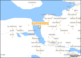
Sunnanäng (Dalarna, Sweden)Sunnanäng is a town in the Dalarna region of Sweden. An overview map of the region around Sunnanäng is displayed below.
regional and 3d topo map of Sunnanäng, Sweden ::
Sunnanäng airports ::
The nearest airport is MXX - Mora, located 31.5 km north west of Sunnanäng.
Other airports nearby include BLE - Borlange (50.2 km south east), GVX - Gavle (110.5 km east), EVG - Sveg (143.9 km north), VST - Vasteras (162.0 km south east), Nearby towns ::
Hjortnäs (1.9km north) //
Sundsnäs (2.6km south west) //
Lima (4.1km south east) //
Tällberg (4.1km north east) //
Grytnäs (4.1km south west) //
Yttre Boda (2.7km east) //
Leksboda (2.7km east) //
Laknäs (5.6km north) //
Fornby (3.3km south west) //
Hjulbäck (3.3km north west) //
Västanvik (5.6km south) //
Vargnäs (4.6km south east) //
Leksands-Noret (5.8km south) //
Övre Boda (3.6km east) //
Åkerö (7.5km south) //
Sätra (4.1km north east) //
Västberg (4.1km north east) //
Karlsarvet (7.5km south) //
Östanhol (6.2km north east) //
Leksand (6.2km south east) //
Övermo (6.2km south east) //
Lisselby (7.6km south) //
Plintsberg (5.2km north east) //
Tibble (6.6km south east) //
Lycka (6.6km south east) //
Yttermo (7.9km south) //
[all distances 'as the bird flies' and approximate]  Places with similar names to Sunnanäng, Sweden :: Disclaimer :: Information on this page comes without warranty of any kind |
||
|
Where is Sunnanäng? Elevation and coordinates ::
Latitude (lat): 60°47'0"N Longitude (lon): 14°58'0"E
(map arrows pan, magnifying glasses zoom) |
||
|
Visiting Sunnanäng? Hotel/Accommodation ::
Book a hotel in Sunnanäng Travel Guide ::
Buy a travel guide for Sweden rental cars ::
car rental offers GPS waypoint ::
download a GPX waypoint (PoI) of Sunnanäng for your GPS receiver
|
||