|
search place name
|
||
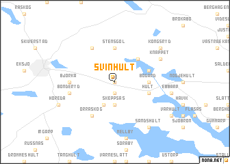
Svinhult (Jönköping, Sweden)Svinhult is a town in the Jönköping region of Sweden. An overview map of the region around Svinhult is displayed below.
regional and 3d topo map of Svinhult, Sweden ::
Svinhult airports ::
The nearest airport is HLF - Hultsfred, located 46.4 km east of Svinhult.
Other airports nearby include JKG - Joenkoeping Jonkoping (61.7 km west), VXO - Vaxjo Kronoberg (83.1 km south), OSK - Oskarshamn (91.1 km east), LPI - Linkoeping Saab (91.3 km north), Nearby towns ::
Fållinge (0.0km north) //
Boaryd (1.9km south) //
Årsås (3.7km south) //
Skeppsås (3.7km south) //
Eldskog (3.8km south) //
Ägersgöl (4.2km north east) //
Bogård (3.0km east) //
Stensgöl (5.6km north) //
Hult (3.5km south east) //
Brunefall (3.5km north east) //
Orraskog (5.9km south) //
Bjässarp (5.9km north) //
Björka (4.0km west) //
Bonderyd (4.4km south west) //
Knäppet (5.4km north east) //
Sandshult (8.0km south) //
Kongsryd (6.8km north east) //
[all distances 'as the bird flies' and approximate] 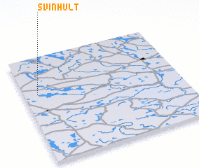
Disclaimer :: Information on this page comes without warranty of any kind |
||
|
Where is Svinhult? Elevation and coordinates ::
Latitude (lat): 57°39'0"N Longitude (lon): 15°5'0"E
Elevation (approx.): 232m (map arrows pan, magnifying glasses zoom) |
||
|
Visiting Svinhult? Hotel/Accommodation ::
Book a hotel in Svinhult Travel Guide ::
Buy a travel guide for Sweden rental cars ::
car rental offers GPS waypoint ::
download a GPX waypoint (PoI) of Svinhult for your GPS receiver
|
||