|
search place name
|
||
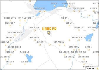
Ubbarp (Jönköping, Sweden)Ubbarp is a town in the Jönköping region of Sweden. An overview map of the region around Ubbarp is displayed below.
regional and 3d topo map of Ubbarp, Sweden ::
Ubbarp airports ::
The nearest airport is JKG - Joenkoeping Jonkoping, located 10.9 km north west of Ubbarp.
Other airports nearby include KVB - Skovde (85.5 km north), VXO - Vaxjo Kronoberg (91.2 km south), HLF - Hultsfred (98.0 km east), LDK - Lidkoping (105.1 km north west), Nearby towns ::
Konungsö (3.7km south) //
Västraby (4.2km south east) //
Lovsjö (4.2km south west) //
Odensjö (3.5km north west) //
Barnarp (3.5km north west) //
Kråkebo (3.5km south west) //
Våeryd (4.8km south east) //
Hundshult (4.4km south east) //
Hult (4.4km south east) //
Åkarp (6.3km north east) //
Bogla (5.4km north east) //
Gullåkra (8.0km south) //
[all distances 'as the bird flies' and approximate] 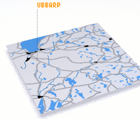 Places with similar names to Ubbarp, Sweden ::
Disclaimer :: Information on this page comes without warranty of any kind |
||
|
Where is Ubbarp? Elevation and coordinates ::
Latitude (lat): 57°42'0"N Longitude (lon): 14°13'0"E
Elevation (approx.): 238m (map arrows pan, magnifying glasses zoom) |
||
|
Visiting Ubbarp? Hotel/Accommodation ::
Book a hotel in Ubbarp Travel Guide ::
Buy a travel guide for Sweden rental cars ::
car rental offers GPS waypoint ::
download a GPX waypoint (PoI) of Ubbarp for your GPS receiver
|
||