|
search place name
|
||
Väbynäs (Blekinge, Sweden)Väbynäs is a town in the Blekinge region of Sweden. An overview map of the region around Väbynäs is displayed below.
regional and 3d topo map of Väbynäs, Sweden ::

Väbynäs airports ::
The nearest airport is RNB - Ronneby, located 13.8 km north east of Väbynäs.
Other airports nearby include KID - Kristianstad (70.8 km west), VXO - Vaxjo Kronoberg (88.5 km north), KLR - Kalkmar Kalmar (91.7 km north east), RNN - Bornholm Ronne (125.1 km south), Nearby towns ::
Rör (0.0km north) //
Vieryd (1.0km east) //
Sonekulla (2.1km north west) //
Biskopsmåla (2.1km west) //
Väby (2.8km north west) //
Lilla Kulleryd (2.8km north west) //
Hakarp (3.8km north) //
Hjälmseryd (2.8km north east) //
Bökevik (2.8km south east) //
Saltärna (2.8km south east) //
Trolleboda (2.7km east) //
Skönevik (3.1km east) //
Svalemåla (3.1km west) //
Garnanäs (3.2km west) //
Mörtjuk (5.7km north) //
Guttamåla (3.6km north east) //
Björstorp (4.8km north west) //
Torp (4.8km north west) //
Dragsnäs (4.1km east) //
Hoby (7.5km north) //
Bräkne-Hoby (7.5km north) //
Gyön (4.5km south west) //
Tokaryd (8.0km north west) //
Bommerstorp (8.5km north east) //
[all distances 'as the bird flies' and approximate] 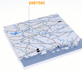
Disclaimer :: Information on this page comes without warranty of any kind |
||
|
Where is Väbynäs? Elevation and coordinates ::
Latitude (lat): 56°10'0"N Longitude (lon): 15°8'0"E
Elevation (approx.): 26m (map arrows pan, magnifying glasses zoom) |
||
|
Visiting Väbynäs? Hotel/Accommodation ::
Book a hotel in Väbynäs Travel Guide ::
Buy a travel guide for Sweden rental cars ::
car rental offers GPS waypoint ::
download a GPX waypoint (PoI) of Väbynäs for your GPS receiver
|
||