|
search place name
|
||
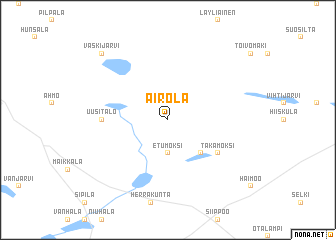
Airola (Etelä-Suomen Lääni, Finland)Airola is a town in the Etelä-Suomen Lääni region of Finland. An overview map of the region around Airola is displayed below.
regional and 3d topo map of Airola, Finland ::
Airola airports ::
The nearest airport is HEL - Helsinki Vantaa, located 38.2 km south east of Airola.
Other airports nearby include HEM - Helsinki Malmi (45.9 km south east), TMP - Tampere Pirkkala (108.9 km north west), TLL - Tallinn-ulemiste International Tallinn (125.3 km south), KEV - Halli (150.7 km north), Nearby towns ::
Etu-Moksi (3.7km south) //
Moksi (4.1km south east) //
Taka-Moksi (4.6km south east) //
Haavisto (3.6km west) //
Uusitalo (3.6km west) //
Vaskijärvi (8.3km north west) //
[all distances 'as the bird flies' and approximate] 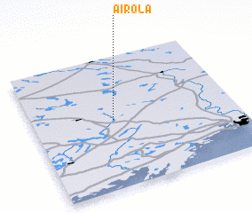 Places with similar names to Airola, Finland ::
Disclaimer :: Information on this page comes without warranty of any kind |
||
|
Where is Airola? Elevation and coordinates ::
Latitude (lat): 60°31'0"N Longitude (lon): 24°24'0"E
(map arrows pan, magnifying glasses zoom) |
||
|
Visiting Airola? Hotel/Accommodation ::
Book a hotel in Airola Travel Guide ::
Buy a travel guide for Finland rental cars ::
car rental offers GPS waypoint ::
download a GPX waypoint (PoI) of Airola for your GPS receiver
|
||