|
search place name
|
||
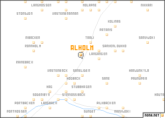
Alholm (Länsi-Suomen Lääni, Finland)Alholm is a town in the Länsi-Suomen Lääni region of Finland. An overview map of the region around Alholm is displayed below.
regional and 3d topo map of Alholm, Finland ::
Alholm airports ::
The nearest airport is VAA - Vaasa, located 30.2 km north of Alholm.
Other airports nearby include KAU - Kauhava (80.0 km north east), KOK - Kruunupyy (128.2 km north east), UME - Umea (132.1 km north west), POR - Pori (147.5 km south), Nearby towns ::
Sorvari (1.9km north) //
Svarvar (1.9km north) //
Långängen (1.7km east) //
Saneliden (3.7km south) //
Granholm (2.5km north east) //
Johannesdal (3.8km north) //
Taali (3.8km north) //
Norrback (4.1km south west) //
Högback (5.6km south) //
Västerback (4.5km south west) //
Dalbacken (5.8km south) //
Berga (5.8km south) //
Stubbhagen (7.4km south) //
Sarvenloukko (3.9km north east) //
Murtoinen (3.9km north east) //
Patarinluokku (6.1km north east) //
Pataris (6.1km north east) //
Sane (6.1km south east) //
Pellasback (7.6km south) //
Kolinas (8.2km north east) //
Kolneback (8.2km north east) //
Hag (8.2km south west) //
[all distances 'as the bird flies' and approximate] 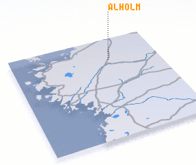 Places with similar names to Alholm, Finland ::
// Al Ḩalamah (LY)
// Alholm (DK)
Disclaimer :: Information on this page comes without warranty of any kind |
||
|
Where is Alholm? Elevation and coordinates ::
Latitude (lat): 62°47'0"N Longitude (lon): 21°40'0"E
(map arrows pan, magnifying glasses zoom) |
||
|
Visiting Alholm? Hotel/Accommodation ::
Book a hotel in Alholm Travel Guide ::
Buy a travel guide for Finland rental cars ::
car rental offers GPS waypoint ::
download a GPX waypoint (PoI) of Alholm for your GPS receiver
|
||