|
search place name
|
||
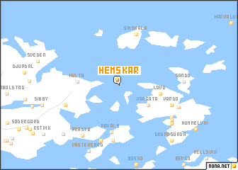
Hemskär (Ahvenanmaa, Finland)Hemskär is a town in the Ahvenanmaa region of Finland. An overview map of the region around Hemskär is displayed below.
regional and 3d topo map of Hemskär, Finland ::
Hemskär airports ::
The nearest airport is MHQ - Mariehamn, located 28.7 km south west of Hemskär.
Other airports nearby include TKU - Turku (110.9 km east), POR - Pori (154.7 km north east), Nearby towns ::
Vargata (3.9km south east) //
Lövö (3.4km east) //
Hulta (3.3km west) //
Påvals (7.3km south) //
Simskäla (8.1km north) //
Töftö (8.7km south) //
Vårdö (5.2km south east) //
Mångstäkta (5.2km south west) //
Horsholm (8.8km south) //
Listersby (6.5km south east) //
Prästö (8.4km south) //
Nedergård (6.8km south east) //
Signedal (7.3km south east) //
Bomarsund (8.8km south west) //
Bomarsund (8.9km south west) //
Grundsunda (9.6km south east) //
[all distances 'as the bird flies' and approximate] 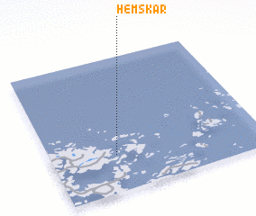 Places with similar names to Hemskär, Finland ::
// Ḩamzah Kūr (IQ)
// Hama-zakurai (JP)
Disclaimer :: Information on this page comes without warranty of any kind |
||
|
Where is Hemskär? Elevation and coordinates ::
Latitude (lat): 60°16'42"N Longitude (lon): 20°18'32"E
(map arrows pan, magnifying glasses zoom) |
||
|
Visiting Hemskär? Hotel/Accommodation ::
Book a hotel in Hemskär Travel Guide ::
Buy a travel guide for Finland rental cars ::
car rental offers GPS waypoint ::
download a GPX waypoint (PoI) of Hemskär for your GPS receiver
|
||