|
search place name
|
||
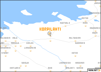
Korpilahti (Länsi-Suomen Lääni, Finland)Korpilahti is a town in the Länsi-Suomen Lääni region of Finland. An overview map of the region around Korpilahti is displayed below.
regional and 3d topo map of Korpilahti, Finland ::
Korpilahti airports ::
The nearest airport is KOK - Kruunupyy, located 17.6 km south west of Korpilahti.
Other airports nearby include KAU - Kauhava (83.2 km south), VAA - Vaasa (118.4 km south west), LLA - Lulea Kallax (195.0 km north), KEM - Kemi Tornio (222.5 km north), Nearby towns ::
 Places with similar names to Korpilahti, Finland ::
// Karapelit (TR)
// Kirpālāti (PK)
// Karapilita (GN)
// Cropalati (IT)
// Karapelit (BG)
// Korpilahti (FI)
// Korpilahti (FI)
// Grippelotte (BE)
Disclaimer :: Information on this page comes without warranty of any kind |
||
|
Where is Korpilahti? Elevation and coordinates ::
Latitude (lat): 63°52'0"N Longitude (lon): 23°17'0"E
(map arrows pan, magnifying glasses zoom) |
||
|
Visiting Korpilahti? Hotel/Accommodation ::
Book a hotel in Korpilahti Travel Guide ::
Buy a travel guide for Finland rental cars ::
car rental offers GPS waypoint ::
download a GPX waypoint (PoI) of Korpilahti for your GPS receiver
|
||