|
search place name
|
||
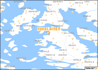
Kukolainen (Länsi-Suomen Lääni, Finland)Kukolainen is a town in the Länsi-Suomen Lääni region of Finland. An overview map of the region around Kukolainen is displayed below.
regional and 3d topo map of Kukolainen, Finland ::
Kukolainen airports ::
The nearest airport is TKU - Turku, located 24.2 km east of Kukolainen.
Other airports nearby include POR - Pori (111.6 km north), MHQ - Mariehamn (113.6 km west), TMP - Tampere Pirkkala (143.1 km north east), Nearby towns ::
Sannainen (1.4km south east) //
Kaukola (3.0km south east) //
Merimasku (3.1km north east) //
Liianmaa (3.8km south) //
Kaksonen (4.7km north) //
Iskola (3.6km south west) //
Horja (2.7km north east) //
Rautuinen (4.8km north) //
Lieranta (5.1km north east) //
Suikkila (7.3km south) //
Mälsälä (4.3km north east) //
Hellemaa (3.8km east) //
Rauvolä (7.7km north) //
Karvatti (8.0km north) //
Lempisaari (4.5km north west) //
Kaastla (8.6km south) //
Kurala (7.2km south) //
Järvensuu (4.6km east) //
Vuorlahti (7.5km north west) //
Hannula (8.9km north) //
Kaamanen (8.5km north) //
Riiainen (9.0km south) //
Kiiainen (9.5km north west) //
[all distances 'as the bird flies' and approximate]  Places with similar names to Kukolainen, Finland ::
// Guiguilonen (PH)
// Kakkulainen (FI)
Disclaimer :: Information on this page comes without warranty of any kind |
||
|
Where is Kukolainen? Elevation and coordinates ::
Latitude (lat): 60°27'38"N Longitude (lon): 21°50'8"E
(map arrows pan, magnifying glasses zoom) |
||
|
Visiting Kukolainen? Hotel/Accommodation ::
Book a hotel in Kukolainen Travel Guide ::
Buy a travel guide for Finland rental cars ::
car rental offers GPS waypoint ::
download a GPX waypoint (PoI) of Kukolainen for your GPS receiver
|
||