|
search place name
|
||
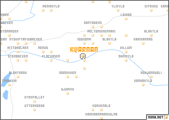
Kvarnån (Länsi-Suomen Lääni, Finland)Kvarnån is a town in the Länsi-Suomen Lääni region of Finland. An overview map of the region around Kvarnån is displayed below.
regional and 3d topo map of Kvarnån, Finland ::
Kvarnån airports ::
The nearest airport is POR - Pori, located 86.3 km south of Kvarnån.
Other airports nearby include VAA - Vaasa (91.2 km north), KAU - Kauhava (122.3 km north east), TMP - Tampere Pirkkala (137.0 km south east), KOK - Kruunupyy (181.9 km north east), Nearby towns ::
Palon (0.0km north) //
Lillsjö (1.9km south) //
Åbacken (2.0km north west) //
Dagsmark (1.7km west) //
Isokorpi (3.7km north) //
Korsbäck (3.8km south) //
Alakuja (3.8km north) //
Norrviken (4.1km south west) //
Lintuvuori (5.6km north) //
Klokkasmäki (5.6km north) //
Peltoniemenmäki (5.8km north) //
Alakylä (4.5km north east) //
Flackåsen (3.5km west) //
Santaheini (7.5km north) //
Böle (3.9km north west) //
Myllärinmäki (6.1km north east) //
Djupvik (7.6km south) //
Karijoki (7.6km north) //
Hongistonmäki (7.6km north) //
[all distances 'as the bird flies' and approximate] 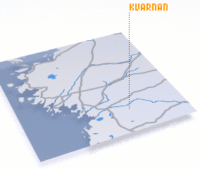 Places with similar names to Kvarnån, Finland ::
// Kovernino (RU)
// Kafr Nān (SY)
// Kafr an Ni‘nā‘ī (EG)
// Kafr ‘Inān (EG)
// Kafr Nūn (LB)
// Kvarnen (SE)
Disclaimer :: Information on this page comes without warranty of any kind |
||
|
Where is Kvarnån? Elevation and coordinates ::
Latitude (lat): 62°14'0"N Longitude (lon): 21°40'0"E
(map arrows pan, magnifying glasses zoom) |
||
|
Visiting Kvarnån? Hotel/Accommodation ::
Book a hotel in Kvarnån Travel Guide ::
Buy a travel guide for Finland rental cars ::
car rental offers GPS waypoint ::
download a GPX waypoint (PoI) of Kvarnån for your GPS receiver
|
||