|
search place name
|
||
Lehtovaara (Itä-Suomen Lääni, Finland)Lehtovaara is a town in the Itä-Suomen Lääni region of Finland. An overview map of the region around Lehtovaara is displayed below.
regional and 3d topo map of Lehtovaara, Finland ::

Lehtovaara airports ::
The nearest airport is JOE - Joensuu, located 51.2 km west of Lehtovaara.
Other airports nearby include SVL - Savonlinna (121.6 km south west), Nearby towns ::
Huhmarisvaara (1.9km south) //
Tokrajärvi (5.6km north) //
Ratilanvaara (4.5km north east) //
Hömötti (6.1km south east) //
Turkola (6.1km south east) //
Autiola (7.6km north) //
[all distances 'as the bird flies' and approximate] 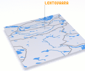 Places with similar names to Lehtovaara, Finland ::
// Liiduvere (EE)
// Lad-Vara (RU)
// Letfuar (ID)
// Lietgheir (SD)
// Leite Faria (MZ)
// Lauttavaara (FI)
// Lehtovaara (FI)
// Lehtovaara (FI)
// Lehtovaara (FI)
// La Davière (FR)
Disclaimer :: Information on this page comes without warranty of any kind |
||
|
Where is Lehtovaara? Elevation and coordinates ::
Latitude (lat): 62°43'0"N Longitude (lon): 30°36'0"E
(map arrows pan, magnifying glasses zoom) |
||
|
Visiting Lehtovaara? Hotel/Accommodation ::
Book a hotel in Lehtovaara Travel Guide ::
Buy a travel guide for Finland rental cars ::
car rental offers GPS waypoint ::
download a GPX waypoint (PoI) of Lehtovaara for your GPS receiver
|
||