|
search place name
|
||
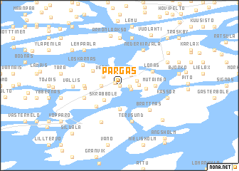
Pargas (Länsi-Suomen Lääni, Finland)Pargas is a town in the Länsi-Suomen Lääni region of Finland. An overview map of the region around Pargas is displayed below.
regional and 3d topo map of Pargas, Finland ::
Pargas airports ::
The nearest airport is TKU - Turku, located 23.9 km north of Pargas.
Other airports nearby include POR - Pori (132.3 km north), TMP - Tampere Pirkkala (143.0 km north east), Nearby towns ::
Storgård (0.0km north) //
Parainen (0.0km north) //
Parsby (0.6km north west) //
Kyrkomalm (0.8km east) //
Norrby (1.9km north) //
Munvik (1.1km south east) //
Norrbyåsen (1.9km north east) //
Bläsnäs (2.1km north west) //
Söderby (1.5km north east) //
Jonsäng (1.4km west) //
Finby (1.9km north west) //
Tennby (1.5km east) //
Vepo (2.3km north west) //
Skräbböle (2.5km south west) //
Gunnarnäs (3.7km south) //
Prästgården (2.1km east) //
Pjukala (3.7km south west) //
Hoggais (3.2km north west) //
Kurkas (2.7km west) //
Muddais (2.8km east) //
Mutainen (2.8km east) //
Sysilax (2.8km west) //
Sysilahti (2.8km west) //
Lönäs (3.4km north east) //
Tervsund (5.6km south) //
Ersby (3.3km south west) //
Brattnäs (4.5km south east) //
Palstakulma (5.9km south) //
Loskarnäs (4.3km north west) //
[all distances 'as the bird flies' and approximate] 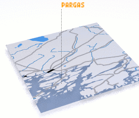 Places with similar names to Pargas, Finland ::
Disclaimer :: Information on this page comes without warranty of any kind |
||
|
Where is Pargas? Elevation and coordinates ::
Latitude (lat): 60°18'0"N Longitude (lon): 22°18'0"E
(map arrows pan, magnifying glasses zoom) |
||
|
Visiting Pargas? Hotel/Accommodation ::
Book a hotel in Pargas Travel Guide ::
Buy a travel guide for Finland rental cars ::
car rental offers GPS waypoint ::
download a GPX waypoint (PoI) of Pargas for your GPS receiver
|
||