|
search place name
|
||
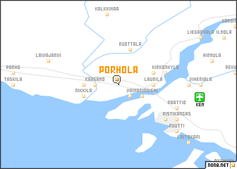
Pörhölä (Lappi, Finland)Pörhölä is a town in the Lappi region of Finland. An overview map of the region around Pörhölä is displayed below.
regional and 3d topo map of Pörhölä, Finland ::
nearby GPS traces from timatio ::
Pörhölä airports ::
The nearest airport is KEM - Kemi Tornio, located 5.7 km east of Pörhölä.
Other airports nearby include RVN - Rovaniemi (104.7 km north east), OUL - Oulu (105.1 km south east), KTT - Kittila (212.6 km north), Nearby towns ::
Hannuerkki (2.0km south) //
Kaakamo (1.5km west) //
Vaimarinniemi (2.4km south east) //
Laurila (2.3km east) //
Kaakamo (2.3km west) //
Ruottala (5.6km north) //
Keminmaa (2.9km north east) //
Nikkilä (2.9km south west) //
Kirkonkylä (3.6km north east) //
Karihaara (6.3km south east) //
[all distances 'as the bird flies' and approximate] 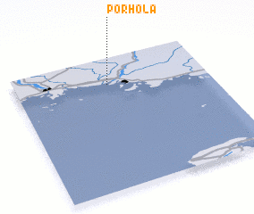 Places with similar names to Pörhölä, Finland ::
Disclaimer :: Information on this page comes without warranty of any kind |
||
|
Where is Pörhölä? Elevation and coordinates ::
Latitude (lat): 65°48'0"N Longitude (lon): 24°29'0"E
(map arrows pan, magnifying glasses zoom) |
||
|
Visiting Pörhölä? Hotel/Accommodation ::
Book a hotel in Pörhölä Travel Guide ::
Buy a travel guide for Finland rental cars ::
car rental offers GPS waypoint ::
download a GPX waypoint (PoI) of Pörhölä for your GPS receiver
|
||