|
search place name
|
||
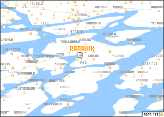
Rånavik (Länsi-Suomen Lääni, Finland)Rånavik is a town in the Länsi-Suomen Lääni region of Finland. An overview map of the region around Rånavik is displayed below.
regional and 3d topo map of Rånavik, Finland ::
Rånavik airports ::
The nearest airport is TKU - Turku, located 22.9 km north of Rånavik.
Other airports nearby include POR - Pori (131.3 km north), TMP - Tampere Pirkkala (138.7 km north east), Nearby towns ::
Björkö (0.6km south west) //
Lillby (1.7km north) //
Pito (1.8km south) //
Kappeliranta (1.7km north) //
Kapellstrand (1.7km north) //
Lielax (1.3km east) //
Lielahti (1.3km east) //
Kuitia (2.7km south) //
Ovidja (2.7km south) //
Nilsby (2.1km north east) //
Kårkulla (3.1km north) //
Kyrkäng (2.2km north west) //
Kårlax (3.5km north) //
Pölsböle (3.2km north) //
Trollgärda (3.3km north west) //
Kassor (4.2km south) //
Lönäs (2.6km west) //
Mutainen (3.2km south west) //
Muddais (3.2km south west) //
Träskby (5.3km north) //
Fagerkulla (4.1km north east) //
Gästerböle (4.5km south east) //
Kirjala (5.5km north) //
Bollböle (3.9km north east) //
Vidkulla (3.5km north east) //
Munkbacka (3.5km north east) //
Prästgården (4.0km south west) //
Signäs (3.8km south east) //
Finnby (7.2km north) //
[all distances 'as the bird flies' and approximate]  Places with similar names to Rånavik, Finland ::
Disclaimer :: Information on this page comes without warranty of any kind |
||
|
Where is Rånavik? Elevation and coordinates ::
Latitude (lat): 60°19'8"N Longitude (lon): 22°23'34"E
(map arrows pan, magnifying glasses zoom) |
||
|
Visiting Rånavik? Hotel/Accommodation ::
Book a hotel in Rånavik Travel Guide ::
Buy a travel guide for Finland rental cars ::
car rental offers GPS waypoint ::
download a GPX waypoint (PoI) of Rånavik for your GPS receiver
|
||