|
search place name
|
||
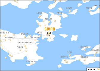
Svinö (Ahvenanmaa, Finland)Svinö is a town in the Ahvenanmaa region of Finland. An overview map of the region around Svinö is displayed below.
regional and 3d topo map of Svinö, Finland ::
Svinö airports ::
The nearest airport is MHQ - Mariehamn, located 21.0 km west of Svinö.
Other airports nearby include TKU - Turku (120.4 km north east), POR - Pori (174.8 km north east), Nearby towns ::
Norrgård (0.2km north west) //
Nygård (1.1km south) //
Åkerlund (0.5km west) //
Ingela (1.6km south) //
Krokstad (1.9km north) //
Skag (1.8km west) //
Lumparland (3.8km north) //
Tullen (5.1km north) //
Lumparby (4.1km north west) //
Haddnäs (3.3km south west) //
Norrboda (5.6km north) //
Solhem (5.5km north) //
Björkhem (4.8km north west) //
Granboda (3.7km west) //
Södergård (7.2km north) //
Ängö (7.6km north) //
Lumpo (7.6km north) //
Flisö (8.3km south east) //
[all distances 'as the bird flies' and approximate]  Places with similar names to Svinö, Finland ::
Disclaimer :: Information on this page comes without warranty of any kind |
||
|
Where is Svinö? Elevation and coordinates ::
Latitude (lat): 60°5'0"N Longitude (lon): 20°16'0"E
(map arrows pan, magnifying glasses zoom) |
||
|
Visiting Svinö? Hotel/Accommodation ::
Book a hotel in Svinö Travel Guide ::
Buy a travel guide for Finland rental cars ::
car rental offers GPS waypoint ::
download a GPX waypoint (PoI) of Svinö for your GPS receiver
|
||