|
search place name
|
||
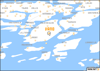
Våno (Länsi-Suomen Lääni, Finland)Våno is a town in the Länsi-Suomen Lääni region of Finland. An overview map of the region around Våno is displayed below.
regional and 3d topo map of Våno, Finland ::
Våno airports ::
The nearest airport is TKU - Turku, located 33.2 km north of Våno.
Other airports nearby include POR - Pori (141.2 km north), TMP - Tampere Pirkkala (151.6 km north east), Nearby towns ::
Granvik (2.1km south west) //
Viggarholm (3.0km south) //
Palstakulma (3.6km north) //
Tervsund (4.1km north east) //
Kärrvik (4.7km south) //
Mielisholm (2.8km east) //
Sildala (3.3km north west) //
Lofsdal (3.3km north west) //
Mågby (3.3km south west) //
Gunnarnäs (5.6km north) //
Pjukala (6.1km north) //
Attu (4.6km south east) //
Skräbböle (7.0km north) //
Träskvik (3.7km west) //
Domarby (3.7km west) //
Sorpo (7.5km south) //
Kopparö (5.2km north west) //
Fallböle (5.2km north west) //
Ersby (7.6km north) //
Brattnäs (6.3km north east) //
Skravsö (4.4km east) //
Ängsholm (4.5km east) //
Tammo (8.8km south) //
Munvik (8.9km north) //
Gundvik (5.8km north east) //
Päivärinta (6.3km south west) //
Simonby (8.3km north west) //
Prästgården (9.3km north) //
[all distances 'as the bird flies' and approximate] 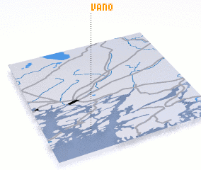 Places with similar names to Våno, Finland ::
Disclaimer :: Information on this page comes without warranty of any kind |
||
|
Where is Våno? Elevation and coordinates ::
Latitude (lat): 60°13'0"N Longitude (lon): 22°17'0"E
(map arrows pan, magnifying glasses zoom) |
||
|
Visiting Våno? Hotel/Accommodation ::
Book a hotel in Våno Travel Guide ::
Buy a travel guide for Finland rental cars ::
car rental offers GPS waypoint ::
download a GPX waypoint (PoI) of Våno for your GPS receiver
|
||