|
search place name
|
||
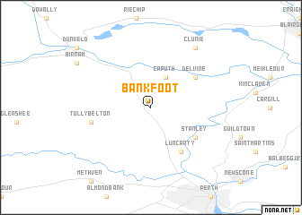
Bankfoot (United Kingdom)Bankfoot is a town in United Kingdom. An overview map of the region around Bankfoot is displayed below.
regional and 3d topo map of Bankfoot, United Kingdom ::
Bankfoot airports ::
The nearest airport is DND - Dundee, located 29.7 km east of Bankfoot.
Other airports nearby include ADX - Leuchars (41.5 km east), EDI - Edinburgh (61.7 km south), GLA - Glasgow (90.8 km south west), ABZ - Aberdeen Dyce (111.5 km north east), Nearby towns ::
 Places with similar names to Bankfoot, United Kingdom ::
// Ban Ko Pho (3) (TH)
// Ban Ku Phadu (TH)
// Bān Nokhvod (IR)
// Bena-Kafutu (CD)
// Bangoufida (NE)
// Ban Kava Tai (LA)
// Baniakafata (ML)
// Bangveti (GE)
// Bản Cò Fat (VN)
// Bankevid (SE)
Disclaimer :: Information on this page comes without warranty of any kind |
||
|
Where is Bankfoot? Elevation and coordinates ::
Latitude (lat): 56°30'0"N Longitude (lon): 3°30'0"W
Elevation (approx.): 94m (map arrows pan, magnifying glasses zoom) |
||
|
Visiting Bankfoot? Hotel/Accommodation ::
Book a hotel in Bankfoot Travel Guide ::
rental cars ::
car rental offers GPS waypoint ::
download a GPX waypoint (PoI) of Bankfoot for your GPS receiver
|
||