|
search place name
|
||
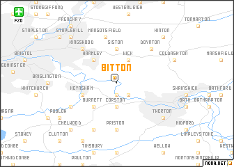
Bitton (United Kingdom)Bitton is a town in United Kingdom. An overview map of the region around Bitton is displayed below.
regional and 3d topo map of Bitton, United Kingdom ::
Bitton airports ::
The nearest airport is FZO - Bristol Filton, located 15.1 km north west of Bitton.
Other airports nearby include BRS - Bristol (19.1 km west), LYE - Lyneham (33.2 km east), YEO - Yeovilton (47.2 km south), FFD - Fairford (54.5 km north east), Nearby towns ::
Saltford (1.9km south) //
Kelston (2.2km south east) //
Corston (3.7km south) //
Wick (3.9km north) //
Warmley (4.4km north west) //
Burnett (4.4km south west) //
Siston (5.6km north) //
Keynsham (3.9km south west) //
Priston (7.4km south) //
Mangotsfield (7.5km north) //
Kingswood (6.6km north west) //
Doynton (6.6km north east) //
Marksbury (7.8km south) //
Compton Dando (5.9km south west) //
Twerton (7.2km south east) //
Staple Hill (8.7km north west) //
Dyrham (8.7km north east) //
Hinton (8.7km north east) //
Chelwood (8.7km south west) //
[all distances 'as the bird flies' and approximate] 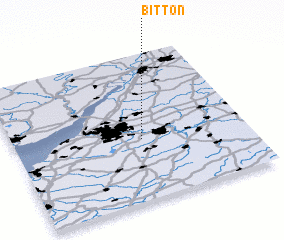 Places with similar names to Bitton, United Kingdom ::
Disclaimer :: Information on this page comes without warranty of any kind |
||
|
Where is Bitton? Elevation and coordinates ::
Latitude (lat): 51°25'0"N Longitude (lon): 2°27'0"W
Elevation (approx.): 13m (map arrows pan, magnifying glasses zoom) |
||
|
Visiting Bitton? Hotel/Accommodation ::
Book a hotel in Bitton Travel Guide ::
rental cars ::
car rental offers GPS waypoint ::
download a GPX waypoint (PoI) of Bitton for your GPS receiver
|
||