|
search place name
|
||
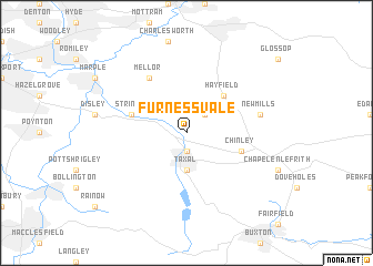
Furness Vale (United Kingdom)Furness Vale is a town in United Kingdom. An overview map of the region around Furness Vale is displayed below.
regional and 3d topo map of Furness Vale, United Kingdom ::
Furness Vale airports ::
The nearest airport is MAN - Manchester, located 19.4 km west of Furness Vale.
Other airports nearby include LPL - Liverpool (57.7 km west), LBA - Leeds Bradford (61.3 km north), CEG - Hawarden (69.1 km west), EMA - Nottingham East Midlands (72.5 km south east), Nearby towns ::
Whaley Bridge (1.9km south) //
Birch Vale (2.2km north east) //
Taxal (3.7km south) //
Hayfield (4.3km north east) //
Strines (3.8km north west) //
Chinley (3.8km south east) //
Mellor (6.0km north) //
New Mills (4.8km north east) //
[all distances 'as the bird flies' and approximate] 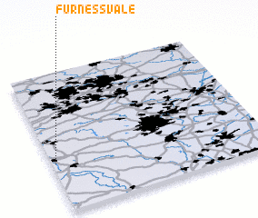 Places with similar names to Furness Vale, United Kingdom ::
// Furnessville (US)
// Franceville (TN)
// Furnaceville (US)
// Furnaceville (US)
// Franceville (GA)
Disclaimer :: Information on this page comes without warranty of any kind |
||
|
Where is Furness Vale? Elevation and coordinates ::
Latitude (lat): 53°21'0"N Longitude (lon): 1°59'0"W
Elevation (approx.): 147m (map arrows pan, magnifying glasses zoom) |
||
|
Visiting Furness Vale? Hotel/Accommodation ::
Book a hotel in Furness Vale Travel Guide ::
rental cars ::
car rental offers GPS waypoint ::
download a GPX waypoint (PoI) of Furness Vale for your GPS receiver
|
||