|
search place name
|
||
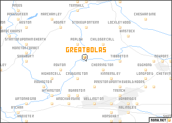
Great Bolas (United Kingdom)Great Bolas is a town in United Kingdom. An overview map of the region around Great Bolas is displayed below.
regional and 3d topo map of Great Bolas, United Kingdom ::
Great Bolas airports ::
The nearest airport is CEG - Hawarden, located 53.1 km north west of Great Bolas.
Other airports nearby include BHX - Birmingham (64.6 km south east), LPL - Liverpool (64.8 km north), MAN - Manchester (65.8 km north), EMA - Nottingham East Midlands (81.5 km east), Nearby towns ::
Cherrington (2.9km south east) //
Crudgington (3.9km south) //
Peplow (3.9km north) //
Childs Ercall (4.3km north east) //
Rowton (3.8km south west) //
Eyton upon the Weald Moors (5.7km south) //
Kinnersley (5.0km south east) //
Tibberton (4.5km east) //
Stoke upon Tern (7.4km north) //
Admaston (7.5km south) //
Allscott (7.7km south) //
High Ercall (5.8km south west) //
Preston upon the Weald Moors (7.1km south east) //
Hodnet (8.1km north west) //
Trench (8.7km south east) //
Lockleywood (8.7km north east) //
Withington (8.7km south west) //
[all distances 'as the bird flies' and approximate] 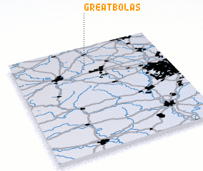 Places with similar names to Great Bolas, United Kingdom :: Disclaimer :: Information on this page comes without warranty of any kind |
||
|
Where is Great Bolas? Elevation and coordinates ::
Latitude (lat): 52°47'0"N Longitude (lon): 2°32'0"W
Elevation (approx.): 57m (map arrows pan, magnifying glasses zoom) |
||
|
Visiting Great Bolas? Hotel/Accommodation ::
Book a hotel in Great Bolas Travel Guide ::
rental cars ::
car rental offers GPS waypoint ::
download a GPX waypoint (PoI) of Great Bolas for your GPS receiver
|
||