|
search place name
|
||
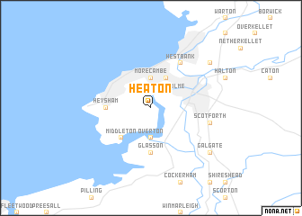
Heaton (United Kingdom)Heaton is a town in United Kingdom. An overview map of the region around Heaton is displayed below.
regional and 3d topo map of Heaton, United Kingdom ::
Heaton airports ::
The nearest airport is BWF - Barrow Island Walney Island, located 29.2 km west of Heaton.
Other airports nearby include BLK - Blackpool (31.4 km south), LPL - Liverpool (77.9 km south), LBA - Leeds Bradford (80.3 km east), MAN - Manchester (84.6 km south east), Nearby towns ::
Torrisholme (2.1km north east) //
Overton (3.7km south) //
Morecambe (3.7km north) //
Lancaster (3.9km north) //
Bare (3.9km north) //
Middleton (4.3km south west) //
Heysham (3.3km west) //
Glasson (5.6km south) //
Hest Bank (6.0km north) //
Scotforth (4.7km south east) //
Bolton le Sands (7.1km north east) //
Galgate (7.1km south east) //
[all distances 'as the bird flies' and approximate]  Places with similar names to Heaton, United Kingdom ::
Disclaimer :: Information on this page comes without warranty of any kind |
||
|
Where is Heaton? Elevation and coordinates ::
Latitude (lat): 54°2'0"N Longitude (lon): 2°51'0"W
Elevation (approx.): 6m (map arrows pan, magnifying glasses zoom) |
||
|
Visiting Heaton? Hotel/Accommodation ::
Book a hotel in Heaton Travel Guide ::
rental cars ::
car rental offers GPS waypoint ::
download a GPX waypoint (PoI) of Heaton for your GPS receiver
|
||