|
search place name
|
||
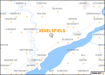
Hewelsfield (United Kingdom)Hewelsfield is a town in United Kingdom. An overview map of the region around Hewelsfield is displayed below.
regional and 3d topo map of Hewelsfield, United Kingdom ::
Hewelsfield airports ::
The nearest airport is FZO - Bristol Filton, located 22.0 km south of Hewelsfield.
Other airports nearby include GLO - Golouchestershire Gloucestershire (36.8 km north east), BRS - Bristol (37.8 km south), LYE - Lyneham (49.2 km south east), FFD - Fairford (57.3 km east), Nearby towns ::
Woolaston (2.2km south east) //
Llandogo (3.9km north west) //
Alvington (3.9km south east) //
Bream (5.1km north east) //
Saint Briavels (5.0km west) //
Newland (7.8km north) //
Tidenham (7.8km south) //
Whitecroft (5.9km north east) //
Sheperdine (7.2km south east) //
Parkend (7.2km north east) //
[all distances 'as the bird flies' and approximate] 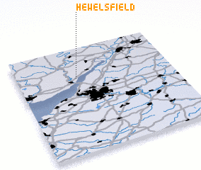 Places with similar names to Hewelsfield, United Kingdom :: Disclaimer :: Information on this page comes without warranty of any kind |
||
|
Where is Hewelsfield? Elevation and coordinates ::
Latitude (lat): 51°43'0"N Longitude (lon): 2°37'0"W
Elevation (approx.): 190m (map arrows pan, magnifying glasses zoom) |
||
|
Visiting Hewelsfield? Hotel/Accommodation ::
Book a hotel in Hewelsfield Travel Guide ::
rental cars ::
car rental offers GPS waypoint ::
download a GPX waypoint (PoI) of Hewelsfield for your GPS receiver
|
||