|
search place name
|
||
Llanbradach (United Kingdom)Llanbradach is a town in United Kingdom. An overview map of the region around Llanbradach is displayed below.
regional and 3d topo map of Llanbradach, United Kingdom ::

Llanbradach airports ::
The nearest airport is CWL - Cardiff, located 23.9 km south of Llanbradach.
Other airports nearby include BRS - Bristol (43.1 km south east), FZO - Bristol Filton (45.4 km east), SWS - Swansea (57.8 km west), YEO - Yeovilton (77.7 km south east), Nearby towns ::
Caerphilly (2.2km south east) //
Bedwas (2.3km east) //
Maes y Cwmmer (3.9km north) //
Ystradmynach (3.9km north) //
Hengoed (5.6km north) //
Senghenydd (3.5km west) //
Nelson (6.0km north) //
Nantgarw (6.0km south west) //
Pengam (7.5km north) //
Gelligaer (7.5km north) //
Mynyddislwyn (5.9km north east) //
Rudry (5.9km south east) //
Taffs Well (7.8km south) //
Lisvane (7.2km south east) //
[all distances 'as the bird flies' and approximate] 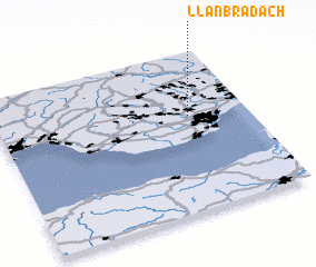 Places with similar names to Llanbradach, United Kingdom :: Disclaimer :: Information on this page comes without warranty of any kind |
||
|
Where is Llanbradach? Elevation and coordinates ::
Latitude (lat): 51°36'0"N Longitude (lon): 3°14'0"W
Elevation (approx.): 101m (map arrows pan, magnifying glasses zoom) |
||
|
Visiting Llanbradach? Hotel/Accommodation ::
Book a hotel in Llanbradach Travel Guide ::
rental cars ::
car rental offers GPS waypoint ::
download a GPX waypoint (PoI) of Llanbradach for your GPS receiver
|
||