|
search place name
|
||
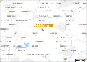
Loddington (United Kingdom)Loddington is a town in United Kingdom. An overview map of the region around Loddington is displayed below.
regional and 3d topo map of Loddington, United Kingdom ::
Loddington airports ::
The nearest airport is CVT - Coventry, located 46.3 km west of Loddington.
Other airports nearby include EMA - Nottingham East Midlands (61.3 km north west), LTN - London Luton (63.8 km south east), BHX - Birmingham (65.0 km west), CBG - Cambridge (69.4 km east), Nearby towns ::
Rothwell (3.7km north) //
Broughton (2.9km south east) //
Faxton (2.9km south west) //
Glaisdale (5.6km north) //
Walgrave (5.7km south) //
Harrington (3.9km north west) //
Desborough (5.7km north) //
Draughton (4.9km west) //
Rushton (6.5km north east) //
Holcot (7.8km south) //
Pytchley (5.9km south east) //
Hardwick (8.2km south east) //
Orlingbury (7.2km south east) //
Braybrooke (8.7km north west) //
[all distances 'as the bird flies' and approximate]  Places with similar names to Loddington, United Kingdom ::
// Ludington (US)
// Ludington (US)
// Leadington (US)
// Ludington (US)
// Lattingtown (US)
// Ludington (US)
// Ludington (US)
// Liddington (GB)
// Liddington (GB)
// Loddington (GB)
Disclaimer :: Information on this page comes without warranty of any kind |
||
|
Where is Loddington? Elevation and coordinates ::
Latitude (lat): 52°23'0"N Longitude (lon): 0°48'0"W
Elevation (approx.): 113m (map arrows pan, magnifying glasses zoom) |
||
|
Visiting Loddington? Hotel/Accommodation ::
Book a hotel in Loddington Travel Guide ::
rental cars ::
car rental offers GPS waypoint ::
download a GPX waypoint (PoI) of Loddington for your GPS receiver
|
||