|
search place name
|
||
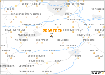
Radstock (United Kingdom)Radstock is a town in United Kingdom. An overview map of the region around Radstock is displayed below.
regional and 3d topo map of Radstock, United Kingdom ::
Radstock airports ::
The nearest airport is BRS - Bristol, located 24.8 km north west of Radstock.
Other airports nearby include FZO - Bristol Filton (29.4 km north west), YEO - Yeovilton (34.8 km south west), LYE - Lyneham (37.5 km north east), FFD - Fairford (61.4 km north east), Nearby towns ::
Hardington (3.0km south east) //
Kilmersdon (3.0km south west) //
Wellow (3.9km north) //
Mells (5.6km south) //
Charlton (3.9km south west) //
Buckland Dinham (5.1km south east) //
Camerton (5.1km north west) //
Norton Saint Philip (5.0km east) //
Hinton Charterhouse (5.9km north east) //
Leigh upon Mendip (8.2km south west) //
Downhead (8.2km south west) //
Limpley Stoke (7.2km north east) //
Midford (8.2km north east) //
Priston (8.2km north west) //
[all distances 'as the bird flies' and approximate]  Places with similar names to Radstock, United Kingdom ::
Disclaimer :: Information on this page comes without warranty of any kind |
||
|
Where is Radstock? Elevation and coordinates ::
Latitude (lat): 51°17'0"N Longitude (lon): 2°24'0"W
Elevation (approx.): 179m (map arrows pan, magnifying glasses zoom) |
||
|
Visiting Radstock? Hotel/Accommodation ::
Book a hotel in Radstock Travel Guide ::
rental cars ::
car rental offers GPS waypoint ::
download a GPX waypoint (PoI) of Radstock for your GPS receiver
|
||