|
search place name
|
||
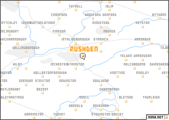
Rushden (United Kingdom)Rushden is a town in United Kingdom. An overview map of the region around Rushden is displayed below.
regional and 3d topo map of Rushden, United Kingdom ::
nearby GPS traces from timatio ::
Rushden airports ::
The nearest airport is LTN - London Luton, located 47.8 km south of Rushden.
Other airports nearby include CBG - Cambridge (52.5 km east), CVT - Coventry (61.9 km west), OXF - Oxford Kidlington (70.8 km south west), STN - London Stansted (71.5 km south east), Nearby towns ::
Higham Ferrers (1.9km north) //
Wymington (2.2km south west) //
Chelveston (2.9km north east) //
Irthlingborough (3.9km north) //
Stanwick (4.3km north east) //
Irchester (3.9km south west) //
Farndish (5.0km south west) //
Souldrop (6.0km south) //
Podington (6.0km south) //
Great Addington (7.4km north) //
Finedon (6.5km north west) //
Raunds (6.5km north east) //
Knotting (5.9km south east) //
Ringstead (7.8km north) //
Sharnbrook (8.2km south east) //
[all distances 'as the bird flies' and approximate] 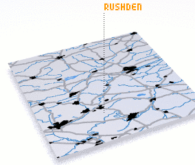 Places with similar names to Rushden, United Kingdom ::
Disclaimer :: Information on this page comes without warranty of any kind |
||
|
Where is Rushden? Elevation and coordinates ::
Latitude (lat): 52°17'0"N Longitude (lon): 0°35'0"W
Elevation (approx.): 80m (map arrows pan, magnifying glasses zoom) |
||
|
Visiting Rushden? Hotel/Accommodation ::
Book a hotel in Rushden Travel Guide ::
rental cars ::
car rental offers GPS waypoint ::
download a GPX waypoint (PoI) of Rushden for your GPS receiver
|
||