|
search place name
|
||
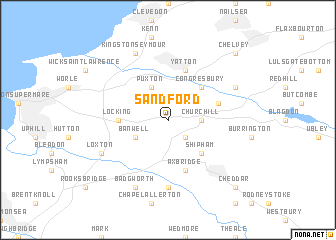
Sandford (United Kingdom)Sandford is a town in United Kingdom. An overview map of the region around Sandford is displayed below.
regional and 3d topo map of Sandford, United Kingdom ::
Sandford airports ::
The nearest airport is BRS - Bristol, located 9.7 km north east of Sandford.
Other airports nearby include FZO - Bristol Filton (26.7 km north east), CWL - Cardiff (36.2 km west), YEO - Yeovilton (38.5 km south), LYE - Lyneham (61.5 km east), Nearby towns ::
Sidcot (2.2km south east) //
Churchill (2.3km east) //
Banwell (3.0km south west) //
Puxton (3.9km north) //
Shipham (4.4km south east) //
Congresbury (4.4km north east) //
Locking (3.5km west) //
Yatton (5.7km north) //
Axbridge (5.7km south) //
Langford (3.9km north east) //
Weare (7.4km south) //
Badgworth (7.8km south) //
Wrington (5.9km north east) //
Loxton (5.9km south west) //
Kingston Seymour (7.8km north) //
Cheddar (8.7km south east) //
Brockley (8.7km north east) //
Chelvey (8.7km north east) //
[all distances 'as the bird flies' and approximate] 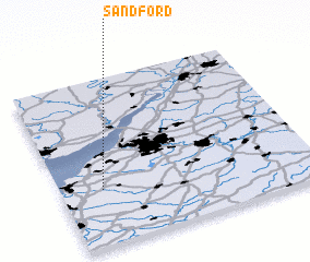 Places with similar names to Sandford, United Kingdom ::
// Sandfort (US)
// Sandford (US)
// Sandförde (DE)
// Sandfort (DE)
// Sandfort (DE)
// Sandford (BB)
// Sandford (GB)
// Sainte-Vertu (FR)
// Saint-Fort (FR)
// Saint-Vert (FR)
Disclaimer :: Information on this page comes without warranty of any kind |
||
|
Where is Sandford? Elevation and coordinates ::
Latitude (lat): 51°20'0"N Longitude (lon): 2°50'0"W
Elevation (approx.): 21m (map arrows pan, magnifying glasses zoom) |
||
|
Visiting Sandford? Hotel/Accommodation ::
Book a hotel in Sandford Travel Guide ::
rental cars ::
car rental offers GPS waypoint ::
download a GPX waypoint (PoI) of Sandford for your GPS receiver
|
||