|
search place name
|
||
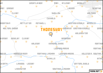
Thoresway (United Kingdom)Thoresway is a town in United Kingdom. An overview map of the region around Thoresway is displayed below.
regional and 3d topo map of Thoresway, United Kingdom ::
Thoresway airports ::
The nearest airport is HUY - Humberside, located 15.9 km north west of Thoresway.
Other airports nearby include WTN - Waddington (37.1 km south west), QCY - Coningsby (40.0 km south), EMA - Nottingham East Midlands (100.5 km south west), KNF - Marham (103.6 km south east), Nearby towns ::
Stainton le Vale (1.9km south) //
Croxby (2.2km north east) //
Kirmond le Mire (3.9km south) //
Rothwell (4.3km north west) //
Cuxwold (5.6km north) //
Thorganby (3.8km north east) //
binbrook (3.8km south east) //
Beelsby (5.0km north east) //
Cabourne (5.0km north west) //
Walesby (5.0km south west) //
Ludford Parva (6.0km south) //
Swinhope (4.4km east) //
Swallow (7.5km north) //
North Willingham (7.5km south) //
Hatcliffe (5.8km north east) //
Irby upon Humber (7.7km north) //
Ludford Magna (8.1km south east) //
[all distances 'as the bird flies' and approximate] 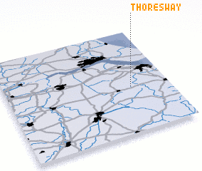 Places with similar names to Thoresway, United Kingdom :: Disclaimer :: Information on this page comes without warranty of any kind |
||
|
Where is Thoresway? Elevation and coordinates ::
Latitude (lat): 53°27'0"N Longitude (lon): 0°14'0"W
Elevation (approx.): 102m (map arrows pan, magnifying glasses zoom) |
||
|
Visiting Thoresway? Hotel/Accommodation ::
Book a hotel in Thoresway Travel Guide ::
rental cars ::
car rental offers GPS waypoint ::
download a GPX waypoint (PoI) of Thoresway for your GPS receiver
|
||