|
search place name
|
||
Tilbury (United Kingdom)Tilbury is a town in United Kingdom. An overview map of the region around Tilbury is displayed below.
regional and 3d topo map of Tilbury, United Kingdom ::

Tilbury airports ::
The nearest airport is LCY - London City, located 22.5 km west of Tilbury.
Other airports nearby include SEN - Southend (26.5 km north east), BQH - Biggin Hill (26.8 km south west), STN - London Stansted (49.2 km north), LGW - London Gatwick (51.4 km south west), Nearby towns ::
Gravesend (1.9km south) //
Low Street (3.0km north east) //
Northfleet (3.0km south west) //
Grays Thurrock (4.4km north west) //
Swanscombe (3.9km south west) //
Stifford (5.1km north west) //
West Tilbury (4.6km east) //
Orsett (7.4km north) //
Sole Street (7.4km south) //
Greenhithe (5.0km west) //
Stanford le Hope (6.6km north east) //
Southfleet (6.6km south west) //
Horndon on the Hill (7.8km north) //
Cobham (7.8km south) //
Shorne (7.2km south east) //
South Ockendon (7.2km north west) //
Longfield (8.2km south west) //
[all distances 'as the bird flies' and approximate] 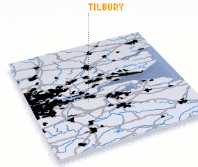 Places with similar names to Tilbury, United Kingdom ::
// Dalebru (NO)
// Dilberi (BA)
// Tal-Liebru (MT)
// Dealu Bîrei (RO)
// Tulburea (RO)
// Tulburea (RO)
// Tulburea (RO)
// Tallobre (ES)
// Delbar (IR)
// Delbar (IR)
Disclaimer :: Information on this page comes without warranty of any kind |
||
|
Where is Tilbury? Elevation and coordinates ::
Latitude (lat): 51°27'0"N Longitude (lon): 0°22'0"W
(map arrows pan, magnifying glasses zoom) |
||
|
Visiting Tilbury? Hotel/Accommodation ::
Book a hotel in Tilbury Travel Guide ::
rental cars ::
car rental offers GPS waypoint ::
download a GPX waypoint (PoI) of Tilbury for your GPS receiver
|
||