|
search place name
|
||
Warrington (United Kingdom)Warrington is a town in United Kingdom. An overview map of the region around Warrington is displayed below.
regional and 3d topo map of Warrington, United Kingdom ::

Warrington airports ::
The nearest airport is LPL - Liverpool, located 17.5 km west of Warrington.
Other airports nearby include MAN - Manchester (21.9 km east), CEG - Hawarden (34.0 km south west), BLK - Blackpool (51.7 km north west), LBA - Leeds Bradford (82.1 km north east), Nearby towns ::
Great Sankey (1.1km west) //
Latchford (2.2km east) //
Winwick (5.6km north) //
Padgate (3.8km north east) //
Moore (5.0km south west) //
Daresbury (6.0km south) //
Appleton (5.0km south east) //
Stretton (6.0km south) //
Newton-le-Willows (7.4km north) //
Newton in Makerfield (7.5km north) //
Croft (6.5km north east) //
Newchurch (7.7km north) //
Preston on the Hill (8.1km south west) //
Burtonwood (7.1km north west) //
Collins Green (7.1km north west) //
Earlestown (8.1km north west) //
Kenyon (8.6km north east) //
[all distances 'as the bird flies' and approximate] 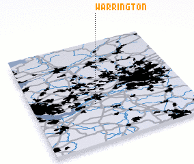 Places with similar names to Warrington, United Kingdom ::
// Warrington (US)
// Warrington (US)
// Warrington (US)
// Warrington (NZ)
// Warrington (US)
// Warrington (US)
// Warrington (US)
// Warrington (GB)
// Werrington (GB)
// Werrington (GB)
Disclaimer :: Information on this page comes without warranty of any kind |
||
|
Where is Warrington? Elevation and coordinates ::
Latitude (lat): 53°23'0"N Longitude (lon): 2°36'0"W
Elevation (approx.): 11m (map arrows pan, magnifying glasses zoom) |
||
|
Visiting Warrington? Hotel/Accommodation ::
Book a hotel in Warrington Travel Guide ::
rental cars ::
car rental offers GPS waypoint ::
download a GPX waypoint (PoI) of Warrington for your GPS receiver
|
||