|
search place name
|
||
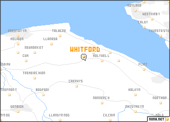
Whitford (United Kingdom)Whitford is a town in United Kingdom. An overview map of the region around Whitford is displayed below.
regional and 3d topo map of Whitford, United Kingdom ::
Whitford airports ::
The nearest airport is CEG - Hawarden, located 23.5 km south east of Whitford.
Other airports nearby include LPL - Liverpool (29.4 km east), BLK - Blackpool (56.9 km north), MAN - Manchester (67.7 km east), BWF - Barrow Island Walney Island (94.4 km north), Nearby towns ::
Mostyn (2.2km north east) //
Holywell (2.2km east) //
Llannerch-y-môr (3.8km north east) //
Caerwys (5.7km south) //
Greenfield (4.4km east) //
Talacre (6.5km north west) //
Llanasa (5.8km north west) //
[all distances 'as the bird flies' and approximate] 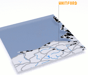 Places with similar names to Whitford, United Kingdom ::
// Whitford (NZ)
// Whitford (US)
// Whiteford (US)
// Whitford (US)
// Whitford (US)
// Haut Fort (HT)
// Haut Fort (HT)
// Haut Fort (HT)
// Hētʼo Ferda (ET)
// Had Fraïta (MA)
Disclaimer :: Information on this page comes without warranty of any kind |
||
|
Where is Whitford? Elevation and coordinates ::
Latitude (lat): 53°17'0"N Longitude (lon): 3°17'0"W
Elevation (approx.): 210m (map arrows pan, magnifying glasses zoom) |
||
|
Visiting Whitford? Hotel/Accommodation ::
Book a hotel in Whitford Travel Guide ::
rental cars ::
car rental offers GPS waypoint ::
download a GPX waypoint (PoI) of Whitford for your GPS receiver
|
||