|
search place name
|
||
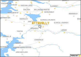
Attavally (Maigh Eo, Ireland)Attavally is a town in the Maigh Eo region of Ireland. An overview map of the region around Attavally is displayed below.
regional and 3d topo map of Attavally, Ireland ::
Attavally airports ::
The nearest airport is NOC - Connaught, located 67.4 km south east of Attavally.
Other airports nearby include SXL - Sligo (77.0 km east), GWY - Galway (109.4 km south east), SNN - Shannon (170.9 km south), KIR - Kerry (220.2 km south), Nearby towns ::
Cloontakilla (1.1km north east) //
Srahgraddy (2.4km south) //
Baingear (1.8km south east) //
Bangor (1.8km south east) //
Srahmore (1.9km south west) //
Gortmore (3.1km north west) //
Glencullin Lower (3.5km north east) //
Croaghaun (6.5km south) //
Srahataggle South (4.7km west) //
Bellanaboy Bridge (7.8km north) //
Muingingaun (7.1km north) //
Ederglen (5.6km north west) //
Derreens (6.6km north west) //
Muingerroon Bridge (7.7km north) //
Carrowmore (7.6km north west) //
Faulagh (8.6km north west) //
[all distances 'as the bird flies' and approximate] 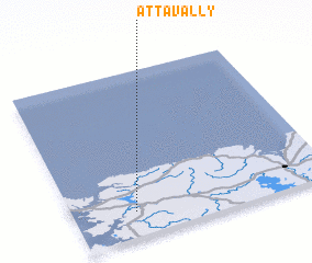 Places with similar names to Attavally, Ireland ::
// Adville (US)
// Adaval (PT)
// Atavola (MG)
// Aţ Ţafīlah (JO)
// Adafila (NG)
// Attavillu (LK)
// Adi-Ghelaʼe (ER)
// Aït Ighil (MA)
// Aït Oufella (MA)
// Ādī Fēla (ET)
Disclaimer :: Information on this page comes without warranty of any kind |
||
|
Where is Attavally? Elevation and coordinates ::
Latitude (lat): 54°9'17"N Longitude (lon): 9°45'36"W
Elevation (approx.): 32m (map arrows pan, magnifying glasses zoom) |
||
|
Visiting Attavally? Hotel/Accommodation ::
Book a hotel in Attavally Travel Guide ::
Buy a travel guide for Ireland rental cars ::
car rental offers GPS waypoint ::
download a GPX waypoint (PoI) of Attavally for your GPS receiver
|
||