|
search place name
|
||
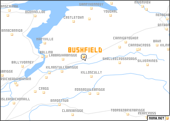
Bushfield (Tiobraid Árann, Ireland)Bushfield is a town in the Tiobraid Árann region of Ireland. An overview map of the region around Bushfield is displayed below.
regional and 3d topo map of Bushfield, Ireland ::
Bushfield airports ::
The nearest airport is SNN - Shannon, located 39.7 km west of Bushfield.
Other airports nearby include GWY - Galway (68.1 km north west), KIR - Kerry (104.9 km south west), ORK - Cork (107.0 km south), WAT - Waterford (110.0 km south east), Nearby towns ::
Killoscully (3.7km south) //
Labbadiha Bridge (2.9km west) //
Kilmastulla Bridge (3.9km south west) //
Rossaguile Bridge (7.3km south) //
Shallee Cross Roads (4.6km east) //
Doonane (7.5km south) //
Ballylusky (5.5km north east) //
Cool Bridge (5.5km south west) //
Ballina (5.3km west) //
Castletown (8.8km north) //
Birdhill (6.4km south west) //
Mary Ville (6.6km north west) //
[all distances 'as the bird flies' and approximate] 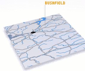 Places with similar names to Bushfield, Ireland ::
// Buchfeld (AT)
// Buchfeld (DE)
// Beachfield (US)
// Beechfield (US)
// Bachfeld (DE)
// Bushfield (AU)
// Bushfield (IE)
// Bushfield (IE)
Disclaimer :: Information on this page comes without warranty of any kind |
||
|
Where is Bushfield? Elevation and coordinates ::
Latitude (lat): 52°47'57"N Longitude (lon): 8°21'31"W
Elevation (approx.): 125m (map arrows pan, magnifying glasses zoom) |
||
|
Visiting Bushfield? Hotel/Accommodation ::
Book a hotel in Bushfield Travel Guide ::
Buy a travel guide for Ireland rental cars ::
car rental offers GPS waypoint ::
download a GPX waypoint (PoI) of Bushfield for your GPS receiver
|
||