|
search place name
|
||
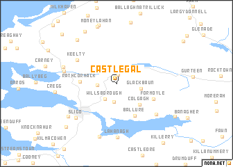
Castlegal (Sligeach, Ireland)Castlegal is a town in the Sligeach region of Ireland. An overview map of the region around Castlegal is displayed below.
regional and 3d topo map of Castlegal, Ireland ::
Castlegal airports ::
The nearest airport is SXL - Sligo, located 12.1 km west of Castlegal.
Other airports nearby include ENK - Enniskillen St Angelo (51.1 km east), NOC - Connaught (52.0 km south west), LDY - Londonderry Eglinton (114.8 km north east), GWY - Galway (118.1 km south), Nearby towns ::
Lugnagall (1.5km north) //
Lisgorey (2.9km south) //
Willsborough (2.6km south west) //
Drum (1.8km west) //
Glackbaun (2.4km east) //
Colgagh (3.9km south east) //
Rathcormack (3.4km west) //
Ballure (5.4km south) //
Formoyle (4.2km south east) //
Keelty (5.2km north west) //
Ballynamona (6.1km south east) //
Lahanagh (8.5km south) //
Sligo (6.7km south west) //
Sligeach (6.7km south west) //
Droim Chliabh (5.3km west) //
Drumcliff (5.3km west) //
Aghamore (8.6km south) //
Milltown (5.6km north west) //
Magheraboy (6.9km south west) //
Ardnaglass Upper (8.0km north west) //
Carrownamaddoo (8.8km north) //
Carrowmore (8.4km south west) //
Grogagh (9.4km north west) //
[all distances 'as the bird flies' and approximate] 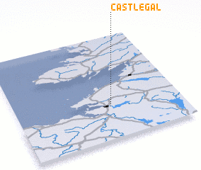 Places with similar names to Castlegal, Ireland ::
// Castlegal (IE)
Disclaimer :: Information on this page comes without warranty of any kind |
||
|
Where is Castlegal? Elevation and coordinates ::
Latitude (lat): 54°18'57"N Longitude (lon): 8°25'27"W
Elevation (approx.): 232m (map arrows pan, magnifying glasses zoom) |
||
|
Visiting Castlegal? Hotel/Accommodation ::
Book a hotel in Castlegal Travel Guide ::
Buy a travel guide for Ireland rental cars ::
car rental offers GPS waypoint ::
download a GPX waypoint (PoI) of Castlegal for your GPS receiver
|
||