|
search place name
|
||
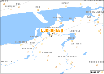
Curraheen (Ciarraí, Ireland)Curraheen is a town in the Ciarraí region of Ireland. An overview map of the region around Curraheen is displayed below.
regional and 3d topo map of Curraheen, Ireland ::
Curraheen airports ::
The nearest airport is KIR - Kerry, located 30.3 km north east of Curraheen.
Other airports nearby include SNN - Shannon (98.4 km north east), ORK - Cork (101.4 km east), GWY - Galway (152.9 km north east), NOC - Connaught (218.6 km north), Nearby towns ::
Doolahag (1.6km north) //
Gleann Beithe (1.1km south west) //
Glenbeigh (1.1km south west) //
Knockaunroe (2.2km north) //
Caragh Bridge (1.7km north east) //
Behy Bridge (2.0km west) //
Glanbeny Bridge (3.4km south west) //
Knockaunnaglashy (5.5km north) //
Ross Behy (3.9km west) //
An Cromán (6.1km north) //
Cromane (6.1km north) //
Creeveen (6.8km south) //
Blackstomes Bridge (5.8km south east) //
Ballynakilly Upper (5.3km south west) //
Baliynakilly (6.1km south west) //
Golagh (4.7km east) //
Drom (5.3km south west) //
Neesha (8.4km south) //
Lake Field (5.3km east) //
Tullig (7.3km north east) //
Gortrelig (6.5km south east) //
Bealtalaw Bridge (8.9km south east) //
Kealduff (7.6km south west) //
[all distances 'as the bird flies' and approximate] 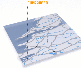 Places with similar names to Curraheen, Ireland ::
Disclaimer :: Information on this page comes without warranty of any kind |
||
|
Where is Curraheen? Elevation and coordinates ::
Latitude (lat): 52°3'44"N Longitude (lon): 9°55'21"W
Elevation (approx.): 26m (map arrows pan, magnifying glasses zoom) |
||
|
Visiting Curraheen? Hotel/Accommodation ::
Book a hotel in Curraheen Travel Guide ::
Buy a travel guide for Ireland rental cars ::
car rental offers GPS waypoint ::
download a GPX waypoint (PoI) of Curraheen for your GPS receiver
|
||