|
search place name
|
||
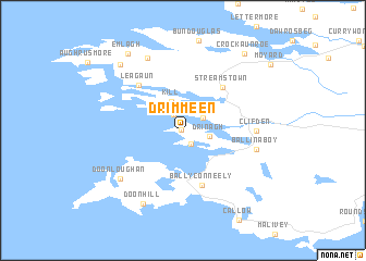
Drimmeen (Ireland)Drimmeen is a town in Ireland. An overview map of the region around Drimmeen is displayed below.
regional and 3d topo map of Drimmeen, Ireland ::
Drimmeen airports ::
The nearest airport is GWY - Galway, located 78.6 km east of Drimmeen.
Other airports nearby include NOC - Connaught (96.1 km north east), SNN - Shannon (116.6 km south east), SXL - Sligo (131.9 km north east), KIR - Kerry (149.8 km south), Nearby towns ::
Errislannan (0.2km north west) //
Curhownagh (1.4km south) //
Belleek (1.8km north) //
Gortrummagh (1.8km north east) //
Drinagh (1.6km east) //
Derreen (2.6km north east) //
Kill (3.1km north) //
Ballyconneely (5.7km south) //
Baile Conaola (5.7km south) //
Streamstown (5.1km north east) //
Leagaun (5.4km north west) //
An Clochán (4.4km east) //
Clifden (4.4km east) //
Ballinaboy (4.8km south east) //
Doonloughan (6.2km south west) //
Cleggan (7.7km north) //
An Cloigeann (7.7km north) //
Doon Hill (7.9km south) //
Claddaghduff (7.8km north west) //
Emlagh (8.6km north west) //
Crockaunroe (8.7km north east) //
[all distances 'as the bird flies' and approximate] 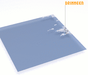 Places with similar names to Drimmeen, Ireland ::
Disclaimer :: Information on this page comes without warranty of any kind |
||
|
Where is Drimmeen? Elevation and coordinates ::
Latitude (lat): 53°29'0"N Longitude (lon): 10°5'0"W
Elevation (approx.): 31m (map arrows pan, magnifying glasses zoom) |
||
|
Visiting Drimmeen? Hotel/Accommodation ::
Book a hotel in Drimmeen Travel Guide ::
Buy a travel guide for Ireland rental cars ::
car rental offers GPS waypoint ::
download a GPX waypoint (PoI) of Drimmeen for your GPS receiver
|
||