|
search place name
|
||
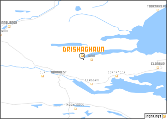
Drishaghaun (Ireland)Drishaghaun is a town in Ireland. An overview map of the region around Drishaghaun is displayed below.
regional and 3d topo map of Drishaghaun, Ireland ::
Drishaghaun airports ::
The nearest airport is GWY - Galway, located 47.3 km south east of Drishaghaun.
Other airports nearby include NOC - Connaught (61.1 km north east), SXL - Sligo (101.2 km north east), SNN - Shannon (102.4 km south east), KIR - Kerry (152.4 km south), Nearby towns ::

Disclaimer :: Information on this page comes without warranty of any kind |
||
|
Where is Drishaghaun? Elevation and coordinates ::
Latitude (lat): 53°33'0"N Longitude (lon): 9°31'0"W
Elevation (approx.): 33m (map arrows pan, magnifying glasses zoom) |
||
|
Visiting Drishaghaun? Hotel/Accommodation ::
Book a hotel in Drishaghaun Travel Guide ::
Buy a travel guide for Ireland rental cars ::
car rental offers GPS waypoint ::
download a GPX waypoint (PoI) of Drishaghaun for your GPS receiver
|
||