|
search place name
|
||
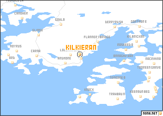
Kilkieran (Gaillimh, Ireland)Kilkieran is a town in the Gaillimh region of Ireland. An overview map of the region around Kilkieran is displayed below.
regional and 3d topo map of Kilkieran, Ireland ::
Kilkieran airports ::
The nearest airport is GWY - Galway, located 53.0 km east of Kilkieran.
Other airports nearby include SNN - Shannon (88.2 km south east), NOC - Connaught (88.9 km north east), KIR - Kerry (128.2 km south), SXL - Sligo (129.9 km north east), Nearby towns ::
Cill Chiaráin (0.0km north) //
Loughamore (1.7km north west) //
Ardmore (2.5km south west) //
Kylesa (3.5km north east) //
Flannery Bridge (4.4km north east) //
Knock (8.5km south) //
Gowla (8.3km north) //
Terranea (7.5km south east) //
Derryrush (8.5km north east) //
[all distances 'as the bird flies' and approximate] 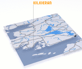 Places with similar names to Kilkieran, Ireland ::
// Kalchrain (CH)
// Kühlgrün (DE)
// Collecaruno (IT)
// Kawle Górne (PL)
// Kloogaranna (EE)
// Călugăreni (RO)
// Călugăreni (RO)
// Călugăreni (RO)
// Călugăreni (RO)
// Călugăreni (RO)
Disclaimer :: Information on this page comes without warranty of any kind |
||
|
Where is Kilkieran? Elevation and coordinates ::
Latitude (lat): 53°19'33"N Longitude (lon): 9°44'7"W
Elevation (approx.): 23m (map arrows pan, magnifying glasses zoom) |
||
|
Visiting Kilkieran? Hotel/Accommodation ::
Book a hotel in Kilkieran Travel Guide ::
Buy a travel guide for Ireland rental cars ::
car rental offers GPS waypoint ::
download a GPX waypoint (PoI) of Kilkieran for your GPS receiver
|
||