|
search place name
|
||
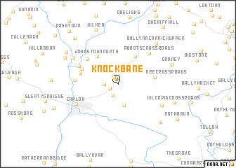
Knockbane (Cill Dara, Ireland)Knockbane is a town in the Cill Dara region of Ireland. An overview map of the region around Knockbane is displayed below.
regional and 3d topo map of Knockbane, Ireland ::
Knockbane airports ::
The nearest airport is DUB - Dublin, located 73.3 km north east of Knockbane.
Other airports nearby include WAT - Waterford (77.4 km south), ORK - Cork (159.1 km south west), NOC - Connaught (174.0 km north west), ENK - Enniskillen St Angelo (177.9 km north), Nearby towns ::
Gorteen Bridge (1.1km north) //
Palatine (1.0km south west) //
Ballylennon Cross Roads (2.0km south) //
Knocknagee Cross Roads (1.3km west) //
Johnstown South (3.1km north) //
Ashlane Cross Roads (3.4km south) //
Castledermot (4.7km north) //
Díseart Diarmada (4.7km north) //
Johnstown North (4.7km north west) //
Knocknacree Cross Roads (3.7km east) //
Gotham Bridge (4.0km north west) //
Dunmanoge (4.2km north west) //
Castleroe Cross Roads (5.0km north west) //
Newtown Bridge (4.7km north west) //
Aghanure (4.2km west) //
Abbotʼs Cross Roads (5.8km north east) //
Ceatharlach (5.1km south west) //
Carlow (5.1km south west) //
Friarstown Bridge (5.4km south east) //
Maganey (5.9km north west) //
Ballynacarrick Upper (7.4km north east) //
Grangeford (7.3km south east) //
Graney (6.0km north east) //
Kilkea (8.8km north) //
Maganey Bridge (6.5km north west) //
Kilcrrig Cross Roads (6.1km south east) //
Ballyfoyle (7.0km north west) //
Duke Street (8.3km north west) //
Rosetown (9.6km north west) //
[all distances 'as the bird flies' and approximate] 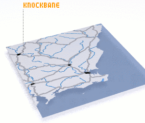 Places with similar names to Knockbane, Ireland ::
Disclaimer :: Information on this page comes without warranty of any kind |
||
|
Where is Knockbane? Elevation and coordinates ::
Latitude (lat): 52°52'10"N Longitude (lon): 6°52'3"W
Elevation (approx.): 69m (map arrows pan, magnifying glasses zoom) |
||
|
Visiting Knockbane? Hotel/Accommodation ::
Book a hotel in Knockbane Travel Guide ::
Buy a travel guide for Ireland rental cars ::
car rental offers GPS waypoint ::
download a GPX waypoint (PoI) of Knockbane for your GPS receiver
|
||