|
search place name
|
||
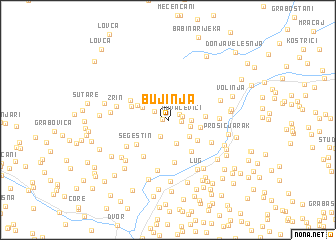
Bujinja (Croatia)Bujinja is a town in Croatia. An overview map of the region around Bujinja is displayed below.
regional and 3d topo map of Bujinja, Croatia ::
Bujinja airports ::
The nearest airport is ZAG - Zagreb, located 68.6 km north west of Bujinja.
Other airports nearby include RJK - Rijeka (145.5 km west), ZAD - Zadar (146.3 km south west), MBX - Maribor (155.6 km north), SPU - Split (182.4 km south), Nearby towns ::
Nožinići (0.5km west) //
Ćorići (1.1km north east) //
Brajinovići (1.0km east) //
Kovačevići (1.2km east) //
Riječani Bujinjski (1.5km north west) //
Gornja Oraovica (1.9km south) //
Miljkovići (1.8km east) //
Šakanlije (1.8km east) //
Donja Oraovica (2.6km south) //
Crnobrnje (2.4km south east) //
Lotine (2.5km north west) //
Jovac (2.7km east) //
Dabići (2.9km north west) //
Riječani Šakanlijski (3.2km south east) //
Kirišnica (2.9km east) //
Divuša (3.9km south east) //
Rogulje (3.3km north west) //
Šegestin (3.6km south west) //
Golubovac Divuški (4.7km south) //
Vukelići (3.7km north west) //
Draškovac (4.5km south west) //
Kozibrod (4.1km south east) //
Adamovići (4.4km south west) //
Kuljani (4.0km east) //
Unčani (5.6km south) //
Zrin (4.4km west) //
Volinjski Jarak (4.6km north east) //
Lug (5.9km south east) //
Draga (4.6km west) //
[all distances 'as the bird flies' and approximate] 
Disclaimer :: Information on this page comes without warranty of any kind |
||
|
Where is Bujinja? Elevation and coordinates ::
Latitude (lat): 45°10'41"N Longitude (lon): 16°25'17"E
Elevation (approx.): 257m (map arrows pan, magnifying glasses zoom) |
||
|
Visiting Bujinja? Hotel/Accommodation ::
Book a hotel in Bujinja Travel Guide ::
Buy a travel guide for Croatia rental cars ::
car rental offers GPS waypoint ::
download a GPX waypoint (PoI) of Bujinja for your GPS receiver
|
||