|
search place name
|
||
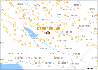
Čerenpolje (Croatia)Čerenpolje is a town in Croatia. An overview map of the region around Čerenpolje is displayed below.
regional and 3d topo map of Čerenpolje, Croatia ::
Čerenpolje airports ::
The nearest airport is SPU - Split, located 40.6 km west of Čerenpolje.
Other airports nearby include OMO - Mostar (89.4 km east), SJJ - Sarajevo (127.5 km east), ZAD - Zadar (132.9 km north west), DBV - Dubrovnik (161.7 km south east), Nearby towns ::
Babići (1.4km north west) //
Tadinac (1.7km south) //
Šarići (1.6km south west) //
Jurišići (1.6km south east) //
Vrkići (1.8km south) //
Sliškovići (1.7km north west) //
Karadže (2.0km north east) //
Tokići (2.2km south) //
Dvožderi (2.4km north) //
Zelići (2.3km north east) //
Pocrnje (2.4km south west) //
Šuški (2.4km north east) //
Pivci (2.4km north west) //
Pleići (3.1km south) //
Budimir (2.9km north) //
Bojana (2.5km south west) //
Ugljane (3.0km north) //
Lukačevići (2.8km south west) //
Smoljanovići (3.2km south) //
Sljujići (3.2km north) //
Škarići (2.5km north east) //
Voloder (2.4km west) //
Periši (3.3km north) //
Nova Sela (2.6km south west) //
Donji Radmani (3.3km north) //
Lozančići (3.1km south west) //
Budići (3.4km north) //
Biorine (2.7km north east) //
Ćavri (3.5km north) //
[all distances 'as the bird flies' and approximate]  Places with similar names to Čerenpolje, Croatia :: Disclaimer :: Information on this page comes without warranty of any kind |
||
|
Where is Čerenpolje? Elevation and coordinates ::
Latitude (lat): 43°32'25"N Longitude (lon): 16°48'0"E
Elevation (approx.): 505m (map arrows pan, magnifying glasses zoom) |
||
|
Visiting Čerenpolje? Hotel/Accommodation ::
Book a hotel in Čerenpolje Travel Guide ::
Buy a travel guide for Croatia rental cars ::
car rental offers GPS waypoint ::
download a GPX waypoint (PoI) of Čerenpolje for your GPS receiver
|
||